Chapter 3: Environment
Background
3.1 Despite its proximity to the city, Rural West Edinburgh is characterised by large areas of open countryside, much of which is of high landscape quality. The local plan area stretches in an arc from the open moorland of the Pentland Hills in the south to the shoreline of the Forth estuary in the north. Three significant waterways, the River Almond, the Union Canal and the Water of Leith cross the area in an approximately west-east direction. Agriculture is the dominant land use in the landscape and several areas of parkland also feature, some laid out as golf courses. The various towns and villages are contrasting urban elements in the landscape as are the three large areas of non-conforming use at Edinburgh Airport, the Royal Highland Showground and Heriot-Watt University's Edinburgh Campus at Riccarton. The area also has several quarries but these are not prominent in the landscape.
3.2 Over half the rural area is in the Green Belt. This urban fringe area has experienced significant development pressure in recent years, particularly on sites next to the City Bypass and along the A8 corridor. Demand for access is high and, as a result, the landscape fabric in some green belt areas has been eroded.
3.3 Agriculture is likely to remain the dominant land use in Rural West Edinburgh. Changes in farming practice affect the use of buildings, the landscape and the wildlife value of the countryside. Government encouragement for diversification of the rural economy as a whole has created pressure for alternative uses of land and buildings.
3.4 The landscape and wildlife value of the countryside is under pressure from these changing practices. The introduction of new land management techniques such as set-aside offers a means of resolving such conflicts and co-ordinating action on environmental improvement and nature conservation. Areas which are particularly fragile include remnants of ancient woodland and sites of nature conservation value, including an internationally important Special Protection Area (SPA), and two nationally important Sites of Special Scientific Interest (SSSIs).
3.5 The countryside of Rural West Edinburgh offers a wide range of opportunities for both active and passive recreation. There are already a number of sites that attract visitor interest although there is no comprehensive network of recreational routes linking them. Conflicts arise from time to time between visitors and existing activities, especially farming. Measures to resolve such conflicts are required.
3.6 The built environment of Rural West Edinburgh comprises towns, villages and country houses and is a rich source of local history. This heritage is protected through the designation of conservation areas and listed buildings. There are seven conservation areas in Rural West Edinburgh: Balerno, Currie, Dalmeny, Hermiston, Kirkliston, Queensferry and Ratho. These are different from the larger conservation areas within the city which may successfully absorb large-scale development. In contrast, the character of villages in the rural area can be damaged by unsympathetic development, however small, and great care will have to be taken to ensure that the character of these areas is adequately protected. The plan area also contains a large number of listed buildings, some set in extensive grounds and parkland, others within settlements. Many of those within parkland settings are coming under pressure for development within their grounds, including conversion to new uses.
National Planning Context
3.7 International agreements and European Union legislation are increasingly important in setting the policy context for local plans and environmental policies. Along with other participating governments, the U.K. government has endorsed the principles of sustainable development.
3.8 At the European level, the Single European Act 1986 specifies the objectives of the E.U. environmental policy:
- to preserve, protect and improve the quality of the environment;
- to contribute towards protecting human health; and
- to ensure a prudent and rational utilisation of natural resources.
Legislation has, consequently, been produced to deal with specific environmental issues of common concern across Europe. Of particular significance for planning are those dealing with habitats and wild birds, waste management and water quality, air quality, major accidents hazards, landfill, access to environmental information, water frameworks and strategic environmental appraisal.
3.9 In Scotland, central government guidance, expressed through Circulars, Planning Advice Notes (PANs), Scottish Planning Policies (SPPs) and their predecessors, National Planning Policy Guidelines (NPPGs), addresses a range of issues including green belts and agricultural land. There is firm support for farming, albeit with an acceptance of lower food production levels, the need for areas of productive land to be set- aside and the possibility of farmers diversifying into other activities as a means of supporting their farming activities. The importance attached to wildlife and nature conservation is also made clear through various Circulars and E.C. Directives. Central Government acknowledges the importance of the design and siting of new development in the countryside - particularly new housing. SPP1 places a greater emphasis on design quality and PAN 36 and PAN 37 suggest that planning authorities should establish clearer policies in this area. NPPG14: 'Natural Heritage' and NPPG18: 'Planning and the Historic Environment' are also relevant.
3.10 Government guidance also seeks to improve the quality of development proposals and to protect the special characteristics of archaeological sites, listed buildings and conservation areas. The Memorandum of Guidance on Listed Buildings and Conservation Areas offers detailed advice to local authorities on policy-making and implementation regarding listed buildings and conservation areas. Government policy is also placing greater importance on good design and achieving high quality environments through new developments.
Structure Plan and Context
3.11 The overarching aim of the Edinburgh and the Lothians Structure Plan 2015 is to provide in full for the development needs of Edinburgh and the Lothians in accordance with the principles of sustainable development, whilst maintaining and enhancing the environmental heritage that underpins the area's quality of life. The strategy is to focus most new development in 'core development areas' that will contribute to these strategic requirements in different ways. The Newbridge/ Kirkliston/Ratho area is identified as a core development area, proposing further housing to accompany the potential for economic growth at Newbridge. The plan designates the remainder of Rural West Edinburgh as an area of development restraint because it is constrained by the Green Belt, landscape, environmental objectives and road capacity. The major objectives of the Structure Plan in relation to the protection and enhancement of the natural and built environment which are relevant to the environment of Rural West Edinburgh are to:
- maintain a continuous green belt around the city;
- ensure that, where possible, brownfield land is developed in preference to greenfield land;
- protect and enhance important landscape settings of settlements and areas of urban green space;
- protect the natural environment from inappropriate or damaging development;
- protect the built and historic environment from overdevelopment and 'town cramming' and promote high standards of design in new development.
Local Plan Objectives
3.12 This local plan aims to protect the open countryside from development, yet encourage appropriate activities to take place, where appropriate. Accordingly, the environmental aims are to:
- ensure that new development meets the objective of sustainable development, in particular the maintenance of biodiversity, and contributes to a healthy and attractive environment within Rural West Edinburgh;
- protect, conserve and enhance the key environmental and heritage resources within the countryside, including landscape, built heritage and important natural habitats;
- protect and enhance the Green Belt and establish long-term defensible boundaries that meet green belt objectives;
- promote access to the countryside and appropriate forms of recreation in a way which minimises conflict between landscape and nature conservation interests and people who live and work there;
- strengthen the economy of the area through support for diversification of an appropriate scale and character which will sustain existing rural uses and activities;
- encourage quality of design in all new forms of development and to protect the character of historic buildings and townscapes in Rural West Edinburgh, ensuring that the traditional grain of settlements is not eroded through unsympathetic development;
- promote the creation of safe, accessible, well-designed environments, taking particular account of the needs of women, children and the disabled; and to
- protect and enhance areas of important recreational and amenity open space within settlements.
Policies and Proposals
Sustainable Development
3.13 Sustainable development is the efficient and effective use of resources (environmental, social and economic) in a long- term framework. The planet's capacity to sustain life is being put as risk and behaviour has to change. A balance must be struck between economic needs and patterns of behaviour so that they do not have a fundamental and irreversible effect on our environment. This is what sustainable development is all about - economic benefits, social well being and protection of the environment - all brought together. Cities and urban regions are vast consumers of energy and it is within these locations that solutions to problems affecting the global environment have to be found. The planning system exists to guide growth and new development and has an established role in weighing its environmental costs and benefits. The growing understanding of the adverse effects of growth on the global environment are, consequently, giving added purpose and urgency to accepted planning concerns.
3.14 The transport system is a major user of energy and its emissions are widely accepted as increasingly damaging to health. The strategy for Edinburgh and the Lothians, and the initiatives which it has given rise to, aims to contain or reduce the need to travel for work and services, and develop a more energy efficient transport system. These initiatives will be supported by development control policies in this local plan. Buildings are also major users of energy. Policies are required to encourage initiatives and building forms which will lead to greater energy efficiency and reduced waste. While proof of energy efficiency is not a requirement of planning permission, it should be encouraged, wherever possible.
3.15 The Environment Act 1995 requires local authorities to periodically review and assess air quality within their areas. When such reviews indicate that an air quality objective will not be achieved, the Council must declare an air quality management area. Following this, a plan of action in pursuit of the objective must be developed for the area and submitted to the Scottish Executive for approval. Scottish Ministers can require authorities to take action if this is not satisfactory. While there are currently no air quality management areas within this plan area, there is a possibility that one or more could be designated in the lifetime of the plan. Developments within the plan area can also affect air quality and air quality management areas outwith the plan area through traffic generation or dispersion of pollutants. Individual developments should not be looked at in isolation and, therefore, the Council will look at the cumulative impacts when considering new development proposals.
3.16 In the context of Rural West Edinburgh, sustainable development requires the following objectives to be met:
- to protect open, rural land and encourage the economical use of land, including appropriate reuse of vacant land, higher densities, where appropriate, and mixed use developments;
- to promote forms of development which support a low energy transport strategy favouring public transport, cycling and walking, and generally reduce the need to travel;
- to introduce initiatives which address air and water pollution and contamination and lead to efficient use of energy and benign disposal of waste;
- to require high standards of energy efficiency in new building and consider the life cycle of the development from the outset;
- to establish and maintain a positive framework for nature conservation, biodiversity and environmental enhancement; and
- to take account of the risk of flooding.
Policy E1 - Sustainable Development
Development which is clearly inconsistent with the local plan objectives for sustainable development will not be permitted. In assessing individual development proposals, account will be taken of the extent to which the development would:
- conserve energy and environmental resources;
- avoid pollution;
- make efficient use of land and infrastructure;
- avoid reliance on the private car for access; and
- maintain or increase biodiversity.
Policy E2 - Local Air Quality Management
Development proposals, especially those affecting Air Quality Management Areas (AQMAs), should not impede the achievement of National Air Quality Objectives. Applications for developments that would significantly contribute to air pollution should be accompanied by an assessment of the likely dispersion of pollutants.
Policy E3 - Energy Efficiency and Waste
The Council will encourage all new development proposals to incorporate features in their design and layout that will maximise energy efficiency and minimise waste.
3.17 These objectives should be applied as widely as necessary and to this end, decisions should be based on the best information as regards environmental impact and consideration given to the full costs and benefits to the environment of allowing a development to proceed. Prospective developers are required to provide the information necessary for the impacts of their proposals to be determined. Thedeveloper should meet the costs of mitigating adverse impacts in line with the 'polluter pays' principle. To assist developers, the Council has prepared supplementary planning guidance on site planning for sustainable development which provides best practice advice on how the principles of sustainable development can in practice be incorporated into individual development proposals. In relation to a limited number of development proposals likely to have significant environmental effects, an Environmental Assessment will be required, through submission of an environmental statement. The Environmental Impact Assessment (Scotland) Regulations 1999 require that Strategic Environmental Impact Assessments will be required for all significant development from July 2004.
Policy E4 - Environmental Impact
All development proposals should fully take into account the likely effects on the environment and include measures necessary to mitigate any adverse effects.
Development in The Green Belt and Countryside
3.18 The Edinburgh Green Belt was first established in 1957 and has subsequently been a keystone of planning policy, helping to shape the development strategy for Edinburgh and the Lothians. It has successfully contained urban areas and maintained their separation. While overall protection for the Green Belt has been a core element in successive structure plans, strategic development needs have, from time to time, led to the planned adjustment of green belt boundaries. The Lothian Structure Plan 1994 proposed a significant extension to the Green Belt in the area between Queensferry, Kirkliston and Winchburgh. The 1994 Structure Plan also required the Lothian authorities to undertake a joint study of the defensibility of current boundaries to confirm these and/or to recommend new defensible boundaries where existing ones are considered 'weak' or to suggest treatment to increase defensibility. This study recommends a number of additions and deletions within the Rural West Edinburgh area to increase the defensibility of boundaries and to include land considered to contribute to green belt objectives.
3.19 Green belt boundaries in this local plan incorporate proposed additions to and deletions from the Green Belt, based on the recommendations in the Edinburgh Green Belt Boundary Study 999, as amended by the requirements of the ELSP. The main extension to the Green Belt is proposed in the area between Queensferry and Kirkliston. This area was identified as having two distinct landscapecharacter zones in the landscape survey. To the east, this is mostly arable farmland rising gently from the River Almond towards Queensferry. To the west, the Dundas Estate presents more dramatic topography and land use variety, containing a loch, woodlands and rocky outcrops. Both areas are well wooded, with numerous trees and copses, and buildings which are by their rural location. The variety of natural features within this tract of countryside makes it an area of distinct landscape quality which fulfils green belt principles by enhancing the settings of Queensferry and Kirkliston. Two other significant additions to strengthen the Green Belt are included in this plan :- land to the south of Kirkliston and to the north-west and south of Balerno.
3.20 In the Green Belt in Rural West Edinburgh, there are three major established uses which are identified in the Structure Plan: Edinburgh Airport, the Royal Highland Showground and Heriot-Watt University's Edinburgh Campus at Riccarton. Although the Structure Plan supports their continued development, the Council proposes that these activities should be retained in the Green Belt to ensure that any directly related development fully respects their green belt settings. The Structure Plan requires that masterplans be prepared for these areas and that, when agreed with the planning authority, these provide the framework and justification for any expansion needs.
3.21 The strategic policy context for controlling development in the Green Belt is established by the Structure Plan. Agriculture, horticulture, forestry and countryside recreation are considered acceptable green belt uses. Recreational uses should be limited to those enabling enjoyment of the countryside and not those which could be located in urban areas. Development associated with the major non-conforming users in the Green Belt, which accords with the relevant Economic Development chapter policies, is also acceptable.
3.22 In Rural West Edinburgh, the areas of countryside not covered by green belt policy are of equivalent environmental importance, even though they do not fulfil green belt objectives. For this reason, the same level of protection will be accorded to countryside areas in the plan area. Accordingly, Policy E5 constrains the kinds of development which will be permitted in a countryside location. In recognition of the opportunities for social and economic development, Policy E5 also allows for development which generally requires a countryside location, such as renewable energy developments and telecommunications. Where development in the countryside is justified, any proposal will be expected to meet the development control criteria of other relevant policies, particularly Policy E6.
3.23 While the Green Belt and countryside areas should be protected from sporadic and isolated new development, there are circumstances where well designed and well located alterations and extensions can be successfully merged into the countryside and which, at the same time, will support the rural economy. Such circumstances generally relate to minor alterations to existing development or appropriate changes of use. The criteria against which the Council will assess such exceptions are outlined in Policy E5. The Council intends preparing supplementary planning guidance on development in the countryside to clarify a number of issues referred to in Policy E5.
Policy E5 - Development in Green Belt and Countryside Areas
To protect the landscape quality, rural character and amenity of the Green Belt and Countryside Policy Areas, development in those areas will not be permitted except:
- where necessary for the purposes of agriculture, including farm diversification, horticulture, forestry, countryside recreation or other uses appropriate to the rural character of those areas, or where a countryside location is essential;
- where acceptable under the policies covering the uses of strategic economic importance identified on the Proposals Map (Policies ED5-7);
- where proposals are for minor extensions and alterations to existing buildings and it can be demonstrated that:
- there would be no materially adverse effect on the openness of the area or its landscape quality or character; and
- it would not lead to an unacceptable intensification of an existing non-conforming use; or
- where proposals are for a change of use of existing buildings and it can be demonstrated that:
- there is no reasonable prospect of achieving a use which conforms to those specified in criterion (a);
- the building(s) is(are) of architectural merit or is (are) a valuable element in the landscape, and is(are) considered worthy of retention; and
- the building(s) is(are) of domestic scale, substantially intact and would require no significant demolition.
3.24 In the few cases where development in the Green Belt or the countryside can be justified in principle, the Council will apply strict criteria in order to protect the landscape quality and the rural character and amenity of Rural West Edinburgh. Policy E6 sets out both a commitment to a higher standard of design of development in the countryside and of the criteria which this authority will take into account in determining such planning applications and notified proposals. The Council recognises that recent changes in farming have resulted in more farm steadings becoming underused and redundant. Reuse of such existing buildings is preferred to new build as many of the former tend to be more sensitively sited and grouped, and often benefit from mature landscaping. Development in the Green Belt or countryside which can be justified must be integrated into the landscape, and the retention, enhancement and integration of existing trees and shelter belts in such proposals is preferred to new planting. Further detailed guidance regarding landscaping is provided by 'Quality of Landscaping in Development' (PDF,108kb) which is part of the Council's Development Quality Handbook. The Council will have regard to this guidance in determining applications for planning permission. The Council must also be satisfied that development proposals, where applicable, make specific provision for species protected under the Conservation (Natural Habitats & c.) Regulations 1994 (Habitat Regulation) and the Wildlife and Countryside Act 1981and the Protection of Badgers Act 1992 (Appendix E).
Policy E6 - Design and Amenity Criteria for development in the Green Belt and Countryside
Where acceptable in principle, development proposals in the Green Belt or countryside must meet the following criteria which aim to achieve high standards of design and landscaping and to safeguard local amenity.
- the proposed development is sited in a location which will minimise impact on its immediate surroundings and general landscape setting and should, where possible, be closely related to an existing building;
- the character and scale of the proposed development should be in keeping with any nearby traditional buildings and should facilitate integration of the development into the rural landscape;
- sufficient landscaping is provided to enhance the setting of the development through the creation of a positive landscape framework that is in keeping with the existing landscape character of the area and that accords with the guidance 'Quality of Landscaping in Developments';
- the existing rural environment and amenity is not detrimentally affected in terms of traffic, noise or air quality (including dust and odour);
- provision is made for the protection of species under the Habitats Regulation and Wildlife and Countryside Act 1981 and the Protection of Badgers Act 1992, where appropriate, and particularly in proposed conversions of barns or other agricultural buildings;
- boundary treatment is appropriate to the rural setting; and
- colours, finishes and materials should be used which blend with the natural environment. Where the proposed development relates to the change of use or conversion/alteration of an existing building, the following additional criteria must be met:
- adequate ground around the buildings exists to meet car parking, amenity and landscaping needs;
- the external character of the existing buildings and their setting are retained in a style appropriate to a rural area;
- the existing buildings are in good structural condition and are capable of conversion without substantial rebuilding;
- no ancillary new buildings are proposed and any repairs or alterations are in traditional materials; and
- in the case of buildings last in agricultural use, that these are redundant and there is no adverse effect on the viability of any remaining land or building for agricultural use.
3.25 Prime agricultural land is a valuable and finite natural resource and should be safeguarded, where possible. Its protection is required by national planning guidelines and Structure Plan policy and is consistent with the objectives of sustainable development. Large areas of agricultural land in Rural West Edinburgh are prime. Alternative use of prime agricultural land may be acceptable, but only where it can be demonstrated that the land can be returned to agriculture in the future and the development proposed is not, therefore, irreversible.
Policy E7 - Protection of Prime Agricultural Land
Permission will not be given for development, which would result in irreversible damage to, or the permanent loss of, prime quality agricultural land.
Nature Conservation, Biodiversity and Areas of Special Environmental Significance
3.26 For over forty years, the Pentland Hills have been designated an 'Area of Great Landscape Value' (AGLV) in recognition of the intrinsic quality of the landscape. This landscape designation has been sustained through the statutory development plan process, commencing with the City of Edinburgh Development Plan in 1965. Circular 2/1962 encouraged authorities to designate AGLV in an attempt to safeguard 'Scotland's natural heritage of scenic beauty'. The AGLV designation conveys:
- the value of the topographical and landscape features which give the Pentland Hills their distinctive appearance;
- the visual prominence of the Hills which dominate the countryside;
- the value of this landscape in maintaining the landscape setting of the city and its neighbouring towns; and
- the value of the Pentland Hills as a major recreational resource for Edinburgh and Lothians.
3.27 Following the confirmation of the Pentland Hills as a Regional Park in 1986, the conservation of the area's landscape quality and protection of its essential character as a place for the peaceful enjoyment of the countryside, has been pursued through the implementation of 'The Pentland Hills Regional Park Subject Local Plan', adopted by the former Lothian Regional Council in 1989. The provisions of the subject plan sustain the AGLV designation.
3.28 Following local government reorganisation, the Pentland Hills Regional Park Joint Committee (PHRPJC) assumed responsibility for reviewing the subject local plan. The Committee agreed to replace the subject local plan with a management strategy which could be prepared, agreed and reviewed regularly to allow management issues relating to the park to be addressed quickly. The policy framework for the Regional Park will be provided by the relevant comprehensive local plans once all are updated and adopted. The subject local plan will then be repealed.
3.29 Development proposals within the park boundaries should conform to the policies of this plan, including the specific policies which relate only to proposals within the Pentland Hills Regional Park boundary, as set out below.
3.30 A landscape survey of the countryside in Rural West Edinburgh was undertaken in 1992/93 as part of the preparation of the draft local plan. In relation to defined landscape character zones, the purpose of the study was to identify areas of exceptional landscape quality. Objective criteria were used to evaluate landscape features such as topography and vegetation cover and detractors such as pylons. Subjective criteria were used to evaluate the intrinsic qualities of the landscape and determine the extent to which one's experience of the landscape was enjoyable and pleasurable. This appraisal did not consider the landscape value of the character zones in terms of their visual prominence. The survey findings, 'An Assessment of the Landscape Quality of Rural West Edinburgh', categorised the countryside and Green Belt into areas of different landscape quality ranging from zones of highest quality to degraded landscapes. Those zones of highest quality are identified on the Proposals Map as 'Areas of Outstanding Landscape Quality' (AOLQs). The purpose of the designation is, as with the Pentland Hills AGLV designation, to safeguard locally important areas of outstanding landscape quality from inappropriate development.
3.31 While it is accepted that perception of the landscape is a unique and personal experience, it is considered that the designated AOLQs represent areas of local importance for natural heritage. Policy E8 seeks to protect and enhance these areas of landscape quality. In determining planning applications, the Council will consider the extent to which the proposed development will retain and enhance features of landscape quality such as tree belts and prominent views.
3.32 In September 1997, Scottish Natural Heritage (SNH) began a review of Scotland's national landscape designation 'National Scenic Areas' and to consider the relationship between these and other landscape designations, including AGLVs. SNH published a report entitled, 'National Scenic Areas - SNH's advice to Government' that calls for a review of the status and purpose of the AGLV designation, given the very wide range of other regional and local designations in operation throughout Scotland. SNH has advised the Scottish Executive that there should only be one landscape designation of regional/local importance, known as a 'Local Scenic Area'. The Executive have asked SNH to develop a consistent approach that Councils can adopt to achieve this end. This exercise may require the Council to review its current approach to landscape designations based upon AOLQs and AGLVs in favour of the identification, designation and protection of 'Local Scenic Areas'. Within the life of this plan, SNH, in conjunction with COSLA, will complete a review on achieving a consistent approach to the creation of local landscape designations.
3.33 The Council made a commitment, through the Consultative Draft Rural West Edinburgh Local Plan 1994 to pursue a direction under Article 4 of the General Permitted Development Order 1992 to control specific classes of permitted development within the areas designated as AOLQs. However, the Council no longer intends to progress this Direction. In the event that the Scottish Executive requires planning authorities to review their landscape designations in accordance with specific advice on the identification and selection process of Local Scenic Areas, the Council will reconsider the merits of controlling specific classes of permitted development in the interests of landscape conservation.
Policy E8 - Areas of Great Landscape Value and Areas of Outstanding Landscape Quality
Within the designated Area of Great Landscape Value and Areas of Outstanding Landscape Quality shown on the Proposals Map, the Council will protect and enhance the quality of the landscape. When determining applications for planning permission for development within these areas, a major consideration will be the impact of proposed development on those landscape features which contribute to the quality of the landscape. Development will not be permitted where it would adversely affect the special scenic qualities and integrity of the Area of Great Landscape Value or Areas of Outstanding Landscape Quality. These landscape features include:
- the patterns of woodland, fields, hedgerows and trees;
- the special qualities of rivers and lochs; and
- skylines and hill features, including prominent views.
The scale, siting, design, form, materials and impact of important landscape features are all aspects of a proposal that could have an adverse effect on AGLVs. These considerations will apply to developments to be located either within or affecting the setting of areas designated as AGLVs or AOLQs.
Policy E9 - Pentland Hills Regional Park - Grouse Moor
With the co-operation of owners and occupiers, Scottish Natural Heritage and other interested bodies, the economic, landscape and nature conservation of the grouse moor will be protected and safeguarded.
Policy E10 - Pentland Hills Regional Park - Car Parks
Public car parks may be permitted on the edge of the Regional Park provided they are related to specific recreational opportunities and designed to integrate with the landscape and character of their surroundings.
Policy E11 - Pentland Hills Regional Park - Picnic Sites
Proposals for formal picnic sites only in the remote hill areas will be permitted if associated with existing facilities and car parking.
3.34 Most of Rural West Edinburgh's coast is categorised as 'undeveloped' as defined by NPPG 13: 'Coastal Planning' and the criteria in PAN 53: 'Classifying the Coast for Planning Purposes'. The definition refers to an area of primarily agricultural and forested land with low intensity recreational uses. The only town on the Rural West Edinburgh coast is Queensferry which developed due to its direct link with the Forth as a ferry crossing and contains sufficient population and infrastructure to fit within the category of 'developed coast' under PAN 53. The 'developed' sections of the Rural West Edinburgh coast are shown on the Proposals Map. It is recognised that some developments, for technical or other reasons, require a coastal location. These include ports, harbours and some tourism, leisure and recreation projects and the onshore elements of North Sea oil and gas developments. In the local plan area, examples of such developments may be seen at Hound Point, which has experienced pressure in recent years for development related to the oil industry and at Port Edgar, where marina, business and housing developments are proposed.
3.35 While large development proposals are likely to present the greatest threat to the natural, cultural or scenic elements of the coastal environment, the cumulative effects of small developments can be equally damaging. As relatively few types of development require a coastal location, the undeveloped coast of Rural West Edinburgh will only be appropriate for development in exceptional circumstances as detailed in Policy E12. In such cases, a rigorous justification will be required in support of development. Where development is to be permitted, it must be demonstrated that all efforts to minimise loss of, and where possible to recreate, affected habitats, have been made.
Policy E12 - Coastline Protection
On the 'developed coast', development proposals will not be permitted unless:
- a coastal location is a functional requirement for the particular type of development proposed; or
- the proposed development would promote the reuse of redundant land or buildings or would enable the restoration or enhancement of a degraded coastal environment. On the 'undeveloped coast', new development will only be permitted in the following exceptional circumstances:
- the proposal would have social and economic benefits sufficient to outweigh any potentially detrimental impact on the coastal environment;
- there are no suitable alternative sites within existing settlements or on other previously developed land; and
- it is demonstrated that there will be minimal loss of habitat and that all efforts will be made to recreate affected habitat. Development involving land reclamation from the sea, which would adversely affect nature conservation or geological interest, or development which may put land at risk from coastal erosion, will not be permitted.
3.36 The Firth of Forth has shaped the history of the area and today represents a key environmental asset for Rural West Edinburgh. It is recognised as an area of international wildlife importance with considerable recreational potential and provides unrivalled views for the many visitors who enter the Lothians via the world famous Forth Bridges. The shoreline is generally well managed throughout its length in the Dalmeny Estate but other areas are of lesser environmental quality. The problems and opportunities presented by the Forth Estuary have been recognised by the establishment of the Forth Estuary Forum, which is a voluntary partnership, established in 1993, made up of members from a range of organisations and backgrounds, including industry, commerce, local government (including the City of Edinburgh Council), recreation and conservation bodies, as well as interested individuals. In August 2002, the Forum developed, in partnership with all users, planners and managers of the Forth, an Integrated Management Strategy, which forms the basis of a new approach to the management of the Forth. It contains guidelines and actions which promote, among other things, sustainable resource management, environmental protection and enhancement, improved access to the Forth and heritage conservation. The Integrated Management Strategy and reviews will be a material consideration in assessing proposals for coastal development.
Policy E13 - The Coast - Access and Management
The Council will support new and improved recreational access to the coast where appropriate, while attempting to minimise impact on nature conservation interest. It will promote environmental improvements with the aim of rehabilitating degraded coastal areas and will work jointly with the relevant authorities, landowners and other bodies as part of the Forth Estuary Forum to prepare and implement the Integrated Management Strategy for the Forth Estuary.
3.37 Historic Scotland and Scottish Natural Heritage have compiled a national Inventory of Historic Gardens and Designed Landscapes. Sites are assessed on the basis of aesthetic, historic, horticultural, architectural, scenic, nature conservation and archaeological value. Development affecting these sites or their setting is subject to consultation with both agencies. An historical landscape appraisal may be requested from applicants to allow full assessment of implications for the site. Twelve inventory 'Designed Landscapes' have been identified within Rural West Edinburgh and are shown on the Proposals Map and listed in Appendix B. In addition, noninventory gardens and landscapes of regional and local importance and their remnant features contribute to cultural significance, quality of environment, landscape diversity and provide setting to historic buildings. All sites with national, regional or local significance may be detrimentally affected by development proposals and Policy E14, therefore, extends to all such features.
Policy E14 - Designed Landscapes
Proposed development which would adversely affect Designed Landscapes of national significance or their setting, as defined in the Inventory, will only be permitted where it assists restoration and would not adversely affect the artistic merit, historical, horticultural, arboricultural, archaeological, architectural, nature conservation or scenic value of the landscape. In seeking to secure such restoration, the Council will liaise with Historic Scotland and Scottish Natural Heritage. Where proposed development would adversely affect other designed landscape features that are worthy of retention, including noninventory historic gardens, surviving features of designed landscapes and mature public parks, the development will only be permitted if the adverse effect has been minimised and is outweighed by public benefits arising from the development.
3.38 Woodlands, trees and hedgerows are also important features, contributing to landscape quality and amenity and are an important part of the diversity of wildlife habitats within the rural area. Their retention is crucial to the maintenance of that quality and diversity. Shelter belts are an important feature in the landscape. The Council has a specific statutory responsibility to ensure that in granting planning permission for new development, provision is made for the protection and planting of trees. Rural West Edinburgh contains a number of long-established or ancient woodlands and trees requiring maintenance and conservation. The protection of such areas takes place through the development control process and the designation of 'Tree Preservation Order's (TPOs) (See Appendix C). The Council will continue to use its powers to make TPOs, where necessary, to protect trees, tree groups and shelter belts. Development proposals must take account of existing mature trees, whether or not they are covered by a TPO, indicating their position and canopy spread on application plans and making provision for their long- term retention in line with current good arboricultural practise.
3.39 The Council will continue to require the planting of new trees through conditions on planning consents, where appropriate. It also supports new planting through its 'Urban Forestry Strategy', to be reviewed shortly, and through support for the revised Forestry Commission grant scheme which came into operation in early 2003, known as the 'Scottish Forestry Grants Scheme'. Two of the types of new grant aid are particularly relevant to the Edinburgh area. Woodland expansion grants encourage expansion of native woodlands with specific emphasis on the development of 'Forest Habitat Networks'. Stewardship grants are available under several relevant categories: to improve woodland biodiversity, particularly in relation to 'local biodiversity action plans'; landscape improvement, for example in relation to the enhancement of designed landscapes and areas of landscape value; woodland recreation, to improve the social value of woodland, ensuring its positive contribution to health and the social inclusion of nearby communities; and for developing community involvement in woodlands.
3.40 Landowners and developers proposing any action that might affect the continued well-being of any trees are encouraged to refer to the Council's Development Quality Handbook. This contains advice and guidance regarding tree protection and urban forestry. These parts of the Handbook will be taken into account by the Council in applying these two policies.
Policy E15 - Protection and Enhancement of Trees and Woodland
Where development proposals are acceptable in principle, the survival and retention of healthy mature trees must be accommodated throughout the construction period and in the proposed layout of buildings. Where development unavoidably involves the loss of woodland, trees or hedgerows, the developer will be required to undertake equivalent replacement planting.
Policy E16 - Trees - Development Impact
The Council will promote Tree Preservation Orders (TPOs) where necessary, to protect significant individual trees, tree groups, woodlands and shelter belts. Once a TPO is confirmed, no new development shall be sited within 20 metres of the trunk of a protected tree or within 10 metres of its canopy, whichever is the greater, unless it can be demonstrated by way of an arboricultural report that no harm to the tree(s) would result during construction, or afterwards, including potential concerns from future occupiers regarding matters such as building and personal safety, daylight, sunlight, or any other perceived risk related to the presence of the trees(s). The Council shall promote, encourage and support additional woodland planting in appropriate areas through its Urban Forestry Strategy, private woodland management schemes and in accordance with the Forestry Commission's identified area of interest. It will promote the enhancement of existing woodlands in terms of biodiversity, cultural and historic interest, social and recreational value and community involvement. The Council will seek to ensure the sympathetic integration of new trees in woodlands, particularly in Areas of Great Landscape Value, where there will be a presumption against large scale coniferous afforestation. Planting of native species, especially hardwood species, will be encouraged in all planting schemes.
Nature Conservation and Biodiversity
3.41 The Council aims to protect and enhance the nature conservation interest and biodiversity of the city and to promote measures which will increase the range and diversity of its wildlife habitats. It is an important aspect of sustainable development that wildlife protection should be incorporated into all aspects of development control and landscape management with a view to maintaining and, where necessary, enhancing biodiversity.
3.42 Rural West Edinburgh contains rich biodiversity and nature conservation resources. A hierarchy of sites of nature conservation interest has been established by national and European legislation. Parts of the Firth of Forth have now been designated a 'Special Protection Area' (SPA) under the E.U. Conservation of Wild Birds Directive (79/409) and as a wetland of international importance under the Ramsar Convention. Within the Plan area, two sites have been designated 'Sites of Special Scientific Interest' (SSSI): Balerno Common and another area that forms part of the Firth of Forth SSSI. The stretch of the Forth Estuary between the Forth Bridge and Cramond contains shoreline, inter-tidal areas and offshore waters of international importance for several species of wildfowl. Other sections of this SSSI, notably at Queensferry Shore and Hound Point, have been identified for their geological importance. The Balerno Common SSSI is a composite of two adjacent sites: Red Moss and Bavelaw Marsh, each having different habitats. Red Moss is a relatively undisturbed area of raised bog while Bavelaw Marsh is an area of open water which is home to a breeding bird community of exceptional quality for this habitat type. In combination, these two sites make the Balerno Common SSSI a unique site in terms of size and diversity of both species and habitat. SNH requires to be consulted on any development proposals affecting sites of international or national interest.
3.43 Protecting the nature conservation interest of sites of national and international importance is the overriding concern when determining potentially damaging development proposals. Development proposals will not be supported unless there would be no adverse effect on the integrity of the site in terms of the coherence of its ecological structure and function and its ability to sustain the habitat, complex of habitats and/or population levels, of the species for which it is classified. These conditions restrict the overall scope for development with a particular presumption against land reclamation in ecologically sensitive areas.
3.44 The increasing awareness and interest in wildlife and nature conservation is reflected in government policies to safeguard and improve wildlife habitat at a local level. As a central tenet of the U.K. Government's commitment to sustainable development, the 'U.K. Biodiversity Action Plan' was completed in 1994. As well as setting national targets for the conservation of wildlife species and habitat, it stressed the need to develop similar plans at a local level. The purpose of local biodiversity action plans is to focus resources on conserving and enhancing biodiversity by means of local partnerships, taking account of both local and national priorities. Edinburgh's Biodiversity Action Plan (EBAP) 2000 was prepared by the 'Edinburgh Biodiversity Partnership', chaired by the Council, and is made up of representatives of numerous organisations. The Partnership has identified 100 key species (from an initial list of over 8,000 recordedfor Edinburgh) and 12 principal habitats. The EBAP is currently under review and will be published in 2004.
Policy E17 - Nature Conservation - Sites of International and National Importance
Development that would affect a Special Protection Area, Ramsar site or Site of Special Scientific Interest (SSSI) will only be permitted where:
- the objectives of designation and the overall integrity of the designated area will not be compromised; or
- any significant adverse effects on the qualities for which the area has been designated are clearly outweighed by social or economic benefits of national importance, and it can be demonstrated that there are no alternative solutions.
An appropriate assessment or Environmental Statement will be required to accompany planning applications affecting such sites.
3.45 The local plan identifies 20 Sites of Importance for Nature Conservation (SINCs) (See Appendix D) which the Council considers to be the most valuable sites in Rural West Edinburgh and, therefore, worthy of the fullest protection. The definition of SINCs includes Regionally Important Geological/ Geomorphological Sites (RIGS) as well as sites identified as important habitat for biodiversity as part of Edinburgh's Biodiversity Action Plan. Many have significance as ecological 'islands' or corridors, especially where they are located within towns and villages. These sites also have a community value in determining local environmental character as well as providing educational and recreational opportunities. The Council aims to support the sympathetic management of these sites and to protect them from potentially damaging development.
Policy E18 - Nature Conservation - Sites of Importance for Nature Conservation
Development within or affecting Sites of Importance for Nature Conservation will not be permitted unless it can be demonstrated that appropriate mitigation measures would be incorporated into the development to enhance or safeguard the nature conservation interest of the site.
3.46 Opportunities to create new SINCs, or to enrich the interest of existing sites, should be taken and will be regarded as a planning advantage if put forward as part of development proposals. Within the life of this plan, SNH, in conjunction with COSLA, will complete a review on achieving a consistent approach to the creation of local wildlife sites. However, action on nature conservation should take place on a broad front and must not be seen as being limited to special areas only. The Council seeks to promote the conservation of important features and visual amenity throughout the countryside as a whole. In addition to protecting SINCs, it is recognised that many sites require ongoing management to maintain and improve their nature conservation value. The establishment of management agreements with landowners and the production of management plans are, therefore, often an important precursor to managing land in an environmentally benign manner. It is also recognised that new areas of value for wildlife need to be created to redress the decline and loss of habitat from previous years. As well as increasing diversity and interest on its own land, the Council will seek opportunities to do likewise on private land.
Policy E19 - Nature Conservation - Management
The Council will encourage sympathetic management of Sites of Importance for Nature Conservation (SINCs) and the creation of new habitats. In particular:
- opportunities for creating wildlife habitats will be examined on land within Council ownership, on privately owned land and where development proposals permit;
- management plans will be prepared for SINCs within Council ownership and the Council will also take full account of wildlife in managing its land generally; and
- the Council will encourage the preparation of management plans for SINCs in private ownership, providing assistance when requested.
Policy E20 - Nature Conservation - Development Impact
Outwith the areas identified in policies E17 and E18, the Council will seek to maintain and improve the nature conservation and biodiversity value of the countryside when considering development proposals. In particular, the impact of proposed development on wildlife, habitat, geological/geomorphological features and the overall landscape will be an important consideration when determining planning applications and commenting on other significant proposals in the wider countryside. Developers will be encouraged to maintain and, where possible, increase the nature conservation value of proposed development sites by enhancing or creating new wildlife habitats, where appropriate.
3.47 Particular classes of permitted development could cause harm to a species or habitat. For example, the erection of a temporary building, laying underground services, or sinking boreholes could have a detrimental impact upon the intrinsic value of a site or cause irreversible damage. NPPG 14: 'Natural Heritage', states that, in certain circumstances, a planning authority may promote a Direction, under Article 4 of the General Permitted Development (Scotland) Order 1992, to withdraw permitted development rights within a designated area. Where the Council has good reason to believe that a site of natural heritage interest may be damaged by implementation of works that are permitted, it will promote a direction. Such a Direction, does not preclude development. However, it does offer the Council an opportunity to control the location, scale and form of a proposed development in relation to the characteristics of a designated site, whether it is of international, national or local importance. In some circumstances, the Council will seek to minimise the environmental impact of a proposal by requiring mitigation measures. The purpose of compensating measures is to retain and enhance features of nature conservation interest and/or prevent the loss, fragmentation or isolation of habitats and associated species.
Policy E21 - Nature Conservation - Article 4 Directions
This policy applies to all the categories of sites of natural heritage interest that are mentioned in policies E17 and E18. Where the Council has good reason to believe that the natural heritage interest of one or more of these sites may be damaged by implementation of works that are permitted in terms of the Town and Country Planning (General Permitted Development) (Scotland) Order 1992, it will promote a direction in terms of Article 4 of the order so that the works in question may no longer be exempt from planning control.
3.48 The Wildlife and Countryside Act 1981, the Habitats Regulation and the Protection of Badgers Act 1992 have significant implications for development affecting protected species, and wilful damage or destruction of legally protected wildlife or their habitat may result in prosecution. This legislation protects a range of species, such as bats, badgers and barn owls. The Council seeks to ensure the survival of these and other species identified as international, national or local biodiversity priorities, reduce disturbance to a minimum and provide enhanced or alternative habitats, where appropriate. Construction and design criteria which the Council will take into consideration in determining development proposals likely to impact on species protected under these Acts is included as Appendix E.
Policy E22 - Nature Conservation - Protected Species
Development proposals which have the potential to result in harm to a protected plant or animal species or its habitat under the Wildlife and Countryside Act 1981, the Habitats Regulation or the Protection of Badgers Act 1992, will not be permitted unless the protection of the species can be secured through appropriate design and construction methods. Scottish Natural Heritage should be notified where there is any evidence of possible occupation of protected species within the site of, or likely to be affected by, a development proposal. Appendix E contains guidance on construction and design criteria that the Council will take into account in determining development proposals likely to impact on species protected under these Acts.
Access and Countryside Recreation
3.49 The Council recognises the increasing popularity of the countryside as a recreational resource for the citizens of Edinburgh and those who live in the rural area. While some activities such as horse riding and walking raise relatively few conflicts, others such as 'war games' are often detrimental to wildlife and nature conservation interests. Providing for countryside recreation is one of the purposes of the Green Belt and the Council will seek to accommodate such proposals where possible, but environmental protection will be the overriding consideration in all cases. This support does not extend to leisure and recreational facilities more appropriately located in urban areas.
Policy E23 - Countryside Recreation
In the Green Belt and countryside policy areas, development, improvement or extension of outdoor recreational and sporting facilities will only be permitted in support of rural diversification if:
- it is well integrated into the rural landscape;
- it reflects the character and quality of place of the landscape;
- it does not result in a significant loss of prime quality agricultural land; and
- any additional infrastructure that is required is provided.
3.50 At present there are no caravan or camping sites in the local plan area. However, caravan and camping holidays form a rapidly growing sector of the tourist market and are important to the City's economy. It is recognised that there may be demand for such facilities in Rural West Edinburgh. In planning terms, a distinction exists between sites for touring caravans and sites for static caravans. Touring caravans are essentially for temporary use serving tourists. Static caravans, including moveable chalets, will be treated in the same way as residential proposals and are not considered acceptable in the Green Belt or countryside policy areas. Certain caravanning organisations can apply for touring caravan exemption certificates from the Scottish Executive which exempt them from the need to obtain planning permission and a site licence where the proposal is to locate not more than five caravans on site.
Policy E24 - Caravan and Camping Development
New sites for touring caravans and camping in the Green Belt and countryside will be permitted where:
- the proposal would not have an adverse impact on the openness of the surrounding countryside and the visual character and quality of landscape in the area;
- natural screening exists or would be provided before any on-site works took place;
- boundary treatment is appropriate to a rural setting;
- proposed colours, finishes and materials are compatible with the natural environment;
- the site is easily accessible from main tourist routes into the city;
- local services are available close to the proposed site;
- the proposal would not result in a significant loss of prime quality agricultural land; and
- any additional infrastructure that is required shall be provided by the developer.
The development of static caravan or chalet sites in the Green Belt or countryside will not be permitted.
3.51 The Planning Advice Note on Golf Courses and Associated Developments (PAN 43) builds on Sportscotland's research into the demand for golf. Their findings indicate that there is demand for the equivalent of over twenty nine-hole golf courses in the Edinburgh area. The PAN recommends that new courses should be located close to major centres of demand to allow most golfers to travel no more than 25 minutes to a course. This should help to reduce the need to travel.
3.52 The provision of golf courses can provide benefits in addition to improved recreational facilities. In Green Belt and countryside areas, golf courses can act as 'buffer zones' between built-up areas and the wider countryside, protecting the landscape setting and preventing coalescence of towns and villages. Any ancillary buildings such as clubhouses and storage needs must be kept to a minimum and sensitively located and designed. Driving ranges are less appropriate in some rural areas, particularly in areas of high landscape value, as they are more intensive users of land, generate higher levels of traffic and normally include floodlighting for evening use and high fencing around the perimeter. The visual impact of such developments will be a key consideration in assessing any golf course or driving range proposal in the countryside of Rural West Edinburgh.
Policy E25 - Golf Courses and Golf Driving Ranges
The development of golf courses and golf driving ranges will be supported provided:
- the biological, geological, historic and cultural interest of any affected site is conserved and enhanced and replacement habitats or features are provided, where appropriate;
- associated development is restricted to the provision of a clubhouse and store. Conversion of existing buildings for these purposes will be encouraged, where appropriate;
- access would be promoted by public transport, bicycle and foot;
- the proposal would not have an adverse impact on the openness of the surrounding countryside and the visual character and quality of landscape in the area;
- the development meets the criteria set out in Policies E6 and E16.
The development of golf driving ranges will normally only be permitted on sites within or adjacent to the urban areas defined on the Proposals Map. Driving ranges, including the design of associated buildings and the provision of car parking, fencing and lighting, must not have an adverse effect on the rural character of the locality.
3.53 The Council has a duty under the Countryside (Scotland) Act 1967 to 'assert, protect and keep free from obstruction' rights of way. Rural West Edinburgh is relatively well provided for in terms of walkways/ cycle routes, many of which follow waterways or disused railway lines through the plan area. Access to a number of large estates in the area is limited although some, such as Dalmeny, contain well-managed footpaths, which are open to the public for limited periods during the year. The Council gives priority to the development of a linked network of walkways/cycle routes in order to expand recreational opportunities and will seek to encourage their development in line with other policies of the plan. Priority will be given to proposals in the Green Belt and along the coast, waterways and disused railway lines. Some routes may be suitable for horse-riding, but this will not be promoted on routes such as the Union Canal towpath where riding could be hazardous. Asserted Rights of Way in Rural West Edinburgh, over which the public have a right to pass, are listed in Appendix F.
Policy E26 - Walkways/Cycle Routes and Rights of Way
The Council will protect and, where appropriate, improve existing rights of way and will seek to create a network of linked walkways/ cycle/horse riding routes throughout the plan area. The Green Belt, the coast, the main waterway corridors and disused railway lines will be priority areas.
3.54 The waterways crossing Rural West Edinburgh are important recreational and wildlife assets. It is essential that the banks and valleys of the River Almond, the Water of Leith and the Bavelaw Burn should be safeguarded for continuing recreational use, permitting them to absorb further pressures for public access yet ensuring that areas of high nature conservation value are protected. 'The River Almond Catchment, A Plan for Integrated Management' was prepared by a partnership of local authorities, government agencies and voluntary groups and organisations in July 1997 to establish a framework for the integrated management of the catchment, which includes the northern part of Rural West Edinburgh as well as to provide an information resource on the state of the catchment. An integrated environmental action plan has been prepared for the Water of Leith which sets out a management strategy for the river and its surroundings. The Union Canal forms part of the Millennium Link project which restored the connection between Glasgow and Edinburgh. The canal's route forms an important green corridor requiring protection and enhancement.
Policy E27 - River Almond, Water of Leith and their Tributaries
The following measures for the protection and enhancement of the recreational potential of the River Almond, Water of Leith and their tributaries will be encouraged and supported:
- the completion of continuous walkway/cycle routes along their banks, where appropriate, and the establishment of footpath links with adjacent sites;
- the completion of a walkway/cycle route along the River Almond between Craigiehall/Cammo and the Queensferry/ Kirkliston walkway/cycle route;
- protection of their exceptional landscape qualities and rural character, and improvement of degraded sites adjacent to the River Almond between the airport and Newbridge; and
- the sensitive management of their banks and defined valleys to consolidate and enhance their value as wildlife corridors.
The Council will seek to enter into agreements with landowners or, if necessary, acquire land to implement this policy.
Policy E28 - Union Canal
To support the protection and enhancement of the Union Canal, the Council will support proposals which:
- involve the protection and sensitive management of canal banks and adjoining areas, particularly the bank which has no towpath, to consolidate and enhance the canal's value as a wildlife corridor;
- ensure the canal remains fully navigable;
- enhance the canal's recreational value without detracting from the quality of its landscape setting; and
- present and maintain an attractive canal frontage; and
- support the sustainable regeneration of the Union Canal as an economic asset by the provision in suitable locations of appropriate canalside canal related development, consistent with other local plan policies.
Archaeology
3.55 Archaeological remains and historic buildings are valuable evidence of Rural West Edinburgh's past; their protection is a key Council objective and a material consideration in determining development proposals which could affect sites with potential archaeological interest. The Council's policies for archaeology and historic buildings are determined primarily by national legislation which relates to the list of Scheduled Ancient Monuments (see Appendix G) and the Statutory List of Buildings of Architectural or Historic Interest compiled by the Secretary of State. Historic Scotland conducts surveys and reviews the lists in consultation with the Council.
Policy E29 - Scheduled Ancient Monuments
Development will not be permitted which fails to ensure the protection, preservation and, if appropriate, the enhancement of a scheduled ancient monument, including its setting.
3.56 Within Rural West Edinburgh, there are over 20 sites that are protected in law by scheduling as 'Ancient Monuments'. These are archaeological sites of national importance. Works to Scheduled Monuments require the prior consent of the Scottish Ministers. The Council will ensure through its general planning powers that neighbouring development does not adversely affect the setting of a Scheduled Monument or important views of it. Many more sites of archaeological interest are not so protected. The most important of these have been identified as 'Sites of Archaeological Significance' and are afforded protection by Policy E30 below. However, many sites of likely archaeological importance remain to be fully investigated and the Council seeks to protect these potential sites in addition to those identified.
3.57 The policies require the value of any remains to be fully assessed, including the likely impact of development on them. Archaeological remains are fragile and finite, and evaluation should be undertaken sensitively to determine their interest and importance of remains. Remains are particularly vulnerable to modern building techniques. Where possible, the Council will seek to have them preserved on site. If this cannot be achieved, developers may be required to conduct an archaeological investigation before development takes place. This is normally a rapid operation, involving ground survey and small-scale trial trenching, often with the use of geophysical survey techniques, carried out by a professionally qualified archaeological organisation or archaeologist approved by the Council's Archaeologist. Any rescue investigation will be required to be conducted in accordance with a project brief to be agreed with the planning authority before consent for development is granted. The Council is committed to preserving, recording and interpreting all sites of archaeological interest for the benefit of the general public.
Policy E30 - Non - Scheduled Archaeological Remains - Archaeological Evaluation
Before any planning application involving development proposals that affect a site of archaeological significance is determined, the applicant will be required to undertake an archaeological field evaluation in consultation with the Council's Archaeologist to determine the interest and importance of archaeological remains. Where a planning application involves development proposals that affect any other site that may have archaeological interest, any permission that is granted will be subject to a condition that requires implementation of a scheme of investigation prior to commencement of development. Wherever possible, the in situ preservation of any remains of importance will be sought. Where preservation is not practicable, a full archaeological investigation, including recording and analysis of the remains and publication of the results, may be required before development commences.
Policy E31 - Archaeology - Management, Education and Awareness
The Council will seek to negotiate management agreements with landowners of important archaeological sites in order to provide for their future preservation, and where appropriate, provide for access and interpretative facilities for the benefit of the public. The Council will also encourage the provision of such facilities through private enterprise.
Historic Buildings
3.58 The Statutory List of Buildings of Special Architectural or Historic Interest identifies the significant elements of the built heritage of Rural West Edinburgh. The rural area contains examples in all categories including several in Category A (nationally important) such as the Forth Rail Bridge and Malleny House. The protection and restoration of listed structures is a fundamental planning objective.
3.59 In considering whether to grant listed building consent, the Council will have special regard to the desirability of preserving the building or its setting or any features of special architectural or historical interest which it possesses. This is a statutory requirement, laid down in section 14(2) of the Planning (Listed Buildings and Conservation Areas) (Scotland) Act 1997. NPP G18: 'Planning and the Historic Environment' sets out the Government's planning policies in relation to the historic environment with a view to its protection, conservation and enhancement. In addition the 'Memorandum of Guidance on Listed Buildings and Conservation Areas' offers detailed advice to local authorities on the approach to be adopted in policy making and implementation in respect of listed buildings and conservation areas and the approach is supported through local plan policies.
3.60 Consent is required from the Council for the demolition of a listed building or structure or for any alteration, whether external or internal, considered likely to affect its character. In determining applications affecting listed buildings, the Council emphasises the importance of safeguarding architectural character and features of historic interest. The Council will prevent avoidable demolition and will seek to protect listed buildings against damaging impacts from necessary alterations.
3.61 The Council has a limited conservation grant budget which may be available to provide assistance towards small-scale restoration and reinstatement work. Priority for funding is individual listed buildings. The Council will continue to encourage good conservation practice in remedial works and serve repair notices, where necessary. Continued close liaison with Historic Scotland will ensure that buildings on the statutory list are kept in good order.
Policy E32 - Listed Buildings
In considering a proposal that affects a listed building or its setting, regard will be had to its effect on the architectural character of the building and its features of historic interest and, if appropriate, its care and restoration. Retention or restoration of architectural character and features of historic interest will be the most important considerations but the extent to which the proposal would bring benefits to the community will also be taken into account. Alterations, extensions or changes of use, including the sub-division of an original dwelling house or development proposals in the surrounding area, will only be permitted where they respect the architectural integrity of the building and its historic interest.
3.62 The policies seek to ensure that listed buildings are retained in appropriate, viable uses and to protect their setting. The use of a listed building has special relevance to its care and restoration. Almost invariably the original purpose for which a building was designed, will be the use through which retention of its character is best assured. Wherever practicable, the Council seeks to retain a building in the use for which it was designed, but suitable alternatives will also be considered to secure a building's future.
Policy E33 - Listed Buildings - Uses
There will be a presumption in favour of the retention of a listed building in, or its restoration to, its original use unless this is clearly inappropriate, in which case the aim should be to identify the best viable use with minimum impact upon the special architectural and historic interest of the building.
3.63 Within the Council's area, there are a number of listed country houses set in their own grounds. Few of these remain in their original setting and many have suffered from unsympathetic development in their grounds. In Rural West Edinburgh, however, there are some excellent examples of estate and country houses which remain almost intact. The Council seeks to protect these valuable elements of the area's heritage. Proposals for development or change of use will, therefore, be assessed in this context.
Policy E34 - Listed Buildings - Uses
To protect the setting and character of listed country houses, development in their grounds will only be permitted where the relationship of the original buildings to their policies is not compromised.
Conservation Areas
3.64 The Council designates conservation areas to define and protect areas of special architectural quality or historic interest and seeks to reinforce the historic grain, character and visual interest of such areas. In addition to buildings, there are unique, important features in each conservation area, including gates, walls, open spaces and landscape features which contribute to an area's character and identity. As the character of a conservation area can be affected by even minor unsympathetic alterations, the full implications of applications for outline permission must be assessed at an early stage, requiring the provision of detailed supporting material. In order to be acceptable, new development must take proper account of the area's character and how it may be conserved and enhanced.
Policy E35 - Conservation Areas - General
Developments in conservation areas will only be permitted where all features which contribute to the special character and appearance of the areas are retained. Such features may include unlisted buildings of townscape interest, boundary walls and railings, historic gardens, trees and landscape features, traditional and natural paving materials, street furniture, and the historic pattern of streets and spaces.
3.65 The Council will exercise tight control over the quality of developments in conservation areas. To complement this work, limited conservation grants may be available on a part-funded basis in those conservation areas where it has been identified, through the conservation area character appraisals, that the original character has been eroded by unsympathetic alteration. The objective of the grants is to enhance the character of the conservation areas through the reinstatement of original features.
3.66 The redevelopment of buildings which are considered by their appearance and scale to be detrimental to the character of the area, will be encouraged. Demolition proposals will be evaluated against the merit and anticipated impact of the proposed replacement building. Where the demolition of an existing building is proposed, conservation area consent will only be granted where an application for a replacement building has been approved and the contract let. Such measures will ensure that the special character of conservation areas is not damaged by the presence of vacant sites or the loss of buildings with no replacement by buildings of an equal or higher design standard.
Policy E36 - Conservation Areas - Development
Development proposals in a conservation area should take into account the area's special interest and how its character and appearance may be preserved or enhanced. Development will be required to be of good architectural quality and relate in mass, scale, design and materials to the existing fabric, respecting the historic pattern of streets and spaces and the principles of established building spacing, building line, roof line and boundary treatment. Alterations to existing buildings should have regard to the special character of the area, and appropriate traditional construction materials should be used. Stone and slate will be requested, where these are appropriate. Where traditional materials are not required, high quality building materials which are in harmony with the essential character of the area, must be used. The redevelopment of buildings which are considered by their appearance and scale to be detrimental to the character of a conservation area will be encouraged. The acceptability of demolition proposals will be evaluated against the merit and anticipated impact of the proposed replacement building. The demolition of an existing building, if approved, shall not take place before an application for a replacement building has been approved and the contract let.
3.67 Positive action is required to rationalise conservation area boundaries in order to make them more defensible and to give a more clearly defined character to the conservation areas. Following the conservation area character appraisal work, the boundaries of all the local plan conservation areas have been reviewed and amended where deemed appropriate. The Proposals Map indicates the location, extent and boundaries of the conservation areas.
Policy E37 - Conservation Areas - Amendments to Boundaries
The Council will review and monitor all the conservation areas in the local plan area.
3.68 Conservation area character appraisals will be prepared throughout the Council's area and will be used in conjunction with existing statutory planning policies, detailed guidance and site-specific development briefs, to assist in the management of conservation areas. The appraisals will form the basis for programmes of enhancement and will provide a sound basis for development control. Applications for significant development within a conservation area should be accompanied by a contextual analysis that demonstrates how the proposals take account of the essential character of the areas as identified in the appraisal. NPPG18 recommends that conservation area character appraisals should be prepared when reconsidering existing conservation area designation, promoting further designations or drawing up enhancement schemes. Councils should consider preparing character appraisals for all conservation areas within their area on a priority basis. Conservation area character appraisals of all seven Rural West Edinburgh Local Plan conservation areas have been completed (after consultation). These have formed the basis for recent conservation area boundary changes and will assist in future management.
Policy E38 - Conservation Areas - Character Appraisal
The Council has prepared conservation character appraisals for all conservation areas in the local plan area. New development will be required to take account of the character of areas identified in character appraisals which will be a material consideration when considering applications for development within the conservation areas and will be used along with other planning policies to assist in their on-going management.
3.69 The Council has additional powers over development in conservation areas, including power over the demolition of buildings. It has widened its development control powers in conservation areas by means of an Article 4 direction in the local plan, which extends planning control to a range of specific alterations, and works which are normally classed as 'permitted development'. These would not normally be the subject of planning applications but collectively they can have an adverse effect on the character and appearance of the conservation area. In accordance with NPPG 18, Article 4 Directions within conservation areas should be supported by a full reasoning and justification of the need for a Direction. This should include a 'conservation area character appraisal', an indication of the characteristics and features to be conserved, information on existing or potential threats to the conservation area, the policy framework, enhancement proposals and consultations undertaken. The Council will be seeking approval to extend existing Article 4 direction orders.
Policy E39 - Conservation Areas - Article 4 Directions
In relation to all conservation areas, the Council has the Secretary of State's approval for a direction made under Article 4 of the General Permitted Development (Scotland) Order 1992, bringing under the planning authority's direct control the following classes of permitted development, as appropriate to each area:
- Development within the curtilage of a dwelling house (classes 1 and 3);
- Erection of a satellite dish (Class 6);
- Treatment of boundaries (Class 7);
- Agriculture buildings and operations (Class 18);
- Development by local authorities (classes 30 and 33); and
- Development by statutory undertakers: water undertakings (Class 38); gas supplies (Class 39); electrical undertakings (Class 40).
Window Alterations
3.70 Unsympathetic alterations to windows can have a detrimental impact on the character of conservation areas. Specific guidelines have been prepared to ensure alterations continue to be of a high standard. The design of windows is controlled to varying degrees in listed buildings, conservation areas and some flatted properties. The policy is set out in more detail in the Development Quality Handbook.
Policy E40 - Window Alterations
Window replacements and alterations will be controlled to protect the special character and appearance of listed buildings and conservation areas. The following criteria will be applied:
- Listed buildings - replacement windows should match the originals in design, materials and methods of operation;
- Non-listed buildings in conservation areas - replacement windows should match original proportions, appearance and materials, including the means of opening in normal use. Where these criteria are met, appropriately designed timber double-glazed units may be acceptable.
Design of New Development
3.71 The Council seeks to promote a high standard of design in all developments in Rural West Edinburgh, regardless of size. Development proposals may be refused, and defended at appeal, solely on design grounds. Many of the settlements within the plan area have a semi-rural character and are of considerable natural and built quality and historic character. They should be treated, in urban design terms, as distinct places. New development in these settlements should enhance their distinctive character through high quality urban and architectural design. It should also respect the rural character around them and the gateways and arterial routes that lead through them. They, and the frequent views to Edinburgh's skylines and features, are very important in giving a first impression of the city, part of which enjoys 'World Heritage' status. High design standards are also expected for relatively minor proposals, including alterations and extensions to existing buildings.
3.72 By encouraging a high standard of design in all new developments based on the mass, scale and outline of existing buildings and townscape, the plan seeks to achieve substantial improvements to the appearance of streets in the towns and villages, and overall environmental quality. Developments should be sensitive and sympathetic to the existing townscape. They should have regard to the effect on the appearance of the area as a whole and to the rural setting or to the streetscene of the towns and villages. In locations that are highly accessible by public transport, or on foot, to the main centres of employment and retailing likely to be used by residents, higher densities may be appropriate.
3.73 It is important that the physical environment reflects the needs of the whole community and particular attention should be given to access for people with mobility difficulties. The needs, for example, of children and the elderly, must be taken into account at the design stage to ensure that an accessible and safe built environment is achieved and maintained. Through its development control powers the Council can influence the design process. To assist in achieving its objectives, the Council prepares design briefs for all significant sites on which development is proposed.
3.74 In the context of sustainable development, new developments are to be encouraged to be energy efficient through innovative design. While proof of energy efficiency is not a requirement of planning permission, it should be encouraged, wherever possible.
Policy E41 - Design of New Development
New development will be required to promote high standards of design for all development and its careful visual and physical integration with its surroundings, built fabric as well as natural environment, in terms of scale, form, siting, street pattern, alignment and materials. It should prevent intrusions into views of the city's landmarks, natural features and skyline. Special attention is required to design quality at gateways and along arterial routes and to densities at accessible locations. Landscape buffers should be provided within new development sites or where a change of use occurs, to soften the transition to adjacent areas, especially where they have a natural heritage designation. New development should improve energy efficiency and reduce noise pollution.
Policy E42 - Quality of New Development
New development will be required to make a positive contribution to the overall character of its context and immediate setting. It must demonstrate high design quality and make provision for accessibility, safety, landscaping, new open spaces and public realm improvements. Good urban design, including architectural and/or landscape features present in or around the site, should be incorporated into the design to full effect. New buildings within settlements should relate closely to the existing settlement pattern.
3.75 Alterations and extensions raise the same need for high standards of design to those of new development. In addition, the Council seeks to ensure that the impact of a proposal on the appearance and character of the existing building and the street scene is generally satisfactory and that there will be no unreasonable loss of amenity and privacy to immediate neighbours through overlooking and overshadowing. The Development Quality Handbook contains supplementary development control guidelines on these issues.
These supplementary policies are material considerations in the determination of applications and give detailed design advice on proposals, ranging from house extensions to major developments and specific uses.
Policy E43 - Alterations and Extensions
Alterations and extensions to existing buildings, where acceptable in principle, should be subservient and relate carefully to the original building. They should be of a suitable scale to the existing building and the space around it and should harmonise with existing details and features. Proposals should preserve the architectural integrity of the existing building and respect its setting.
3.76 There has been pressure for development in the grounds of traditional stone- built villas. The Council seeks to preserve and enhance the character of stone- built villa areas and to achieve this objective, specific guidelines have been drawn up to cover densities, areas of garden ground, building forms and their location. The policy seeks to retain the stone- built character, the general low density of built form and the high proportion of garden ground. Buildings should be appropriate in their siting, quality and design. The policy covers any use and relevant conditions may be attached to gap sites. The policy is set out in full in the Development Quality Handbook.
Policy E44 - New Development in Villa Areas
New development in the garden grounds of detached or semidetached houses of a traditional, usually stone- built character, will not be permitted where it would lead to the loss of character or amenity. Development must be in accordance with the guideline 'Villa Areas and the Grounds of Villas' (PDF,59kb) in the Council's Development Quality Handbook.
Flood Risk and Surface Water Requirements
3.77 National guidance on the approach the planning system can take to minimising flood risk is contained in NPPG 7: 'Planning and Flooding'. The City of Edinburgh Council's guidance 'Planning and Flooding' (PDF,628kb) is included in the Development Quality Handbook.
3.78 The Scottish Environment Protection Agency (SEPA) maintains records of flow in some rivers and issues emergency flood warnings. It is also a statutory consultee on planning applications where flooding issues may arise and is consulted on the preparation of structure and local plans.
3.79 Assessments as to whether a proposed development is in an area of flood risk, or may increase the risk of flooding elsewhere, will be made on an individual basis with reference made to information that is available as to the extent of previous flood events. A protocol has been agreed to consult SEPA regarding flood risk on all applications involving:
- Realignment of an existing watercourse;
- Construction of a structure over or adjacent to a watercourse;
- Construction of a new watercourse;
- Additional discharge into a watercourse; or
- Construction on land adjacent to a watercourse.
3.80 Many watercourses are not shown on record plans, especially where they have been culverted. A flood risk can be created if any existing watercourse, culvert or field drain is interfered with during development. It is the responsibility of developers to ensure that adequate site investigation is carried out.
3.81 Identified areas of importance for flood control are shown on the Proposals Map. The areas that have been identified are:
- Currently of value for water storage in the event of flooding; and
- Are not currently occupied by built development.
3.82 The areas identified are indicative only, representing the best available current information on the extent of land that is of value for flood water storage. In the event of development proposals being considered within or adjacent to these areas, the Council will take account of more detailed survey work that may help to define them more accurately. The areas identified are not comprehensive and, as a general principle, the Council will be wary of approving development in any area of undeveloped flat/low-lying land that may be of value for the storage of flood water.
3.83 Areas of importance for flood control are by definition also areas of flood risk. However, areas of flood risk are not necessarily considered to be of value for flood control. Each site must be considered on an individual basis. The use of 'sustainable urban drainage systems'(SUDS) is encouraged as a means of counteracting some of the negative drainage impacts of new development closer to source. However, in certain circumstances the choice of SUDS may be limited, for example, on some constrained brownfield sites or where heavily compacted ground conditions occur, or where the introduction of a water feature may conflict with CAA's defined safeguarded area within which it seeks to reduce the risk of birdstrike (see Policy ED10). However, in most cases the use of features outlined in guideline 4 (above) can help to lower peak floods and reduce the amount of pollution from run-off entering watercourses. Many of the measures associated with SUDS can also have benefits for wildlife and the landscaping of development through the creation of temporarily or permanently wet ponds and wetlands. Further guidance on this issue is contained in 'Sustainable Urban Drainage Systems - Design manual for Scotland and Northern Ireland' (CIRIA, 2000), the SEPA documents 'Watercourses in the Community' (PDF,4.7MB) and 'Ponds, Pools and Lochans' (PDF,299kb) and the 'Edinburgh Biodiversity Action Plan'. The Council will work with SEPA, Scottish Water, the Civil Aviation Authority and other relevant organisations to identify SUDS options and agree on design criteria.
Policy E45 - Flooding
- Control of development in all areas subject to a risk of flooding
Where acceptable in principle, development in areas subject to flood risk will be assessed according to its vulnerability to flooding and the relative risk of flooding on the site. As a general principle, all new residential and business development should be designed to avoid or manage any threat to susceptible properties from a 200 year return period flood. An appropriate freeboard should be provided and an allowance may be made for climate change. - Areas of importance for flood control
Within identified areas of importance for flood control, or any other area of value for the storage of flood water, there will be a presumption against development that will significantly reduce its water storage capacity, including landraising and flood prevention measures, unless:- it can be demonstrated that adequate compensatory water storage can be provided; and
- proposals for provision of such compensatory water storage are submitted with any planning application. If acceptable in principle, the implementation of compensatory water storage will be secured through planning condition or legal agreement.
- Minimisation of flood risk
Development which may lead to a significant increase in the risk of flooding will not be permitted. New development proposals should protect existing watercourses and avoid the introduction of new culverts or works detrimental to the effectiveness of existing flood defences. The removal of existing culverts and the restoration of watercourses to their natural form will be strongly encouraged. Proposals for flood protection or alleviation works should take account of the principles of this guideline and other relevant policies for the built and natural environment. - Minimising pollution and run-off
New development should be designed to minimise any increase in surface water run-off and resulting pollution to local watercourses. The following measures should be utilised where appropriate:
- minimise the proportion of impermeable surfacing and maximise the use of permeable surfaces;
- swales and soakaways to allow a proportion of the run-off from impermeable areas to soak into the ground;
- detention basins to handle large volumes of storm water and release it into local watercourses over time at a manageable rate;
- retention ponds to handle storm water and allow settlement and some biological treatment;
- wetlands incorporating shallow ponds and marsh to allow the biological treatment and filtration of storm water; and
- oil traps to prevent the pollution of ground water.
In all cases such measures will be required to maximise the benefits for biodiversity and enhance landscape quality.
Policy E46 - Surface Water Run-off
Planning applications should demonstrate that proposals will not result in a significant increase in surface water run-off relative to the capacity of the receiving water course in flood risk areas. Sustainable Urban Drainage Systems (SUDS) will be required to minimise the pollution of watercourses and must be designed to meet the requirements of the Council, Scottish Water, SEPA, CAA and other relevant authorities.
Advertisements, Telecommunications, Public Art
3.84 Advertisements are controlled in terms of the Town and Country Planning (Control of Advertisements) (Scotland) Regulations 1984 (as amended). The regulations stipulate that control of advertisements may be exercised only in the interests of amenity and public safety. Government policy regarding advertisement control is contained in Scottish Development Department Circular 10/1984. This says that advertisements are an integral part of modern commercial life and their presence in many street scenes will enhance the environment by adding colour and interest. The circular also points out that stricter control of advertisements may be appropriate in certain areas, for example, certain predominantly rural areas or areas with important architectural, archaeological, historical or visual characteristics. All applications for approval of advertisements in the area covered by the local plan will be carefully assessed in relation to the form, size and means of illumination (if any) of the proposed display. Control will be exercised to ensure that advertisements do not detract from the character of conservation areas nor from the appearance of the main approaches to the city.
Policy E47 - Advertisements
All advertisements will be carefully controlled in their form, dimensions and means of illumination to minimise their impact in the interests of amenity and public safety. Proposals for the display of advertisements will be controlled to ensure that they do not detract from the character of conservation areas and the main approaches to the city.
3.85 The development of mobile phone telecommunications services brings many benefits to the city, but a consequence is likely to be a continued expansion in the size and number of telecommunications installations by the operators. There are concerns that such development can have an adverse visual impact on both urban and rural surroundings, particularly where located on prominent buildings or in open countryside. It is, therefore, important that new telecommunications installations are sited and designed to minimise their appearance on the surrounding environment. It is essential that the minimum practical amount of equipment is erected and, wherever possible, existing structures and masts are used. Telecommunications installations proposed in environmentally sensitive areas must be designed so that they are unobtrusive. Impact on important natural resources such as landscape and wildlife should be avoided but where this is not possible, impact must be minimised by appropriate design. When submitting proposals that need planning consent, operatorswill need to demonstrate that they have selected that site following careful assessment of alternative sites and designs. NPPG19 seeks to enable the telecommunications industry to expand and diversify while at the same time minimising the environmental impact of new or replacement equipment. The amendments to the General Permitted Development Order in 2001 set out the specific telecommunication developments that do and do not require the grant of specific planning permission. Advice on siting and design is contained in PAN62.
Policy E48 - Telecommunications Development - Locational Criteria
Development will be supported except where it would:
- cause an unacceptable impact on an important natural resource;
- cause an unacceptable reduction in the levels of amenity; or
- cause unnecessary visual damage to the environment, including the character, appearance, setting and context of sensitive and designated areas of natural and built heritage.
When assessing the location of proposed telecommunications development, regard shall be had to the technical and operational requirements of the network
Policy E49 - Telecommunications Development - Design Requirements
Where acceptable in principle, in the terms of the location criteria outlined in Policy E48, telecommunications development should be sited and designed to minimise visual impact, with applicants demonstrating that the following factors have been taken into account:
- the possibility of sharing existing telecommunications facilities;
- the possibility of erecting radio antennae on an existing building or other structure;
- technical and operational considerations; and
- the availability of alternative sites.
3.86 The Council wishes to encourage the involvement of private developers and others in the creation of a high quality environment. Such initiatives require the co-ordination of resources and efforts by the Council, Scottish Enterprise Edinburgh and Lothian and other public and private sector agencies. In Rural West Edinburgh, priority will be given to the main approaches to the city. On these routes, the Council will seek to encourage contributions towards the enlivenment and enrichment of the environment through public art.
Policy E50 - Public Art
Support will be given for public art which enhances the main approaches to the city, buildings and spaces and which contributes to the visual interest and quality of the public environment.
Open Space
3.87 Open space is an essential component of the built environment and provides areas with setting and identity. The protection of open space is important to both present and future generations as once an area of open space has been built upon, it is likely that the space will be permanently lost. Open space provision in the towns and villages of Rural West Edinburgh consists of areas such as public parks, children's play areas, playing fields, amenity open space, walkways/cycle routes, woodland and civic spaces. It plays a fundamental role in meeting the sporting and other recreational needs of local communities and visitors, and it is important for the well-being of local residents and generally enhances the character of the urban environment. While open space provides for recreational needs, in planning terms it is equally important to the amenity of an area.
3.88 Not all open space in Rural West Edinburgh is currently available for use by all sectors of the community. However, areas of private open space or spaces with restricted public access still help meet recreational needs in the area. There may be an opportunity in the future for such areas to be made available for use by local communities. All areas of open space can be important in terms of amenity or nature conservation value.
3.89 The Proposals Map identifies areas of open space which are widely recognised as having significant recreational, amenity and nature conservation value. Policy E51, however, applies to all areas of public and private open space. It gives the same level of protection to spaces of recreational, amenity and nature conservation value which are not shown on the map.
3.90 In seeking to protect open space, the Council will take into account the impact of a proposal on the recreational value of an area of open space. Recreational open space includes playing fields and sports pitches, other sporting facilities, such as tennis courts and bowling greens, public parks,children's play areas and linear routes. Proposals resulting in the loss of recreational open space will not normally be permitted unless the Council is satisfied that there is a long term excess of provision in the wider area.
3.91 In accordance with NPPG 11: 'Sport, Physical Recreation and Open Space', and advice set out in PAN65: 'Planning and Open Space', the Council is preparing an Open Space Framework for the city. The Executive of the Council approved a steering group, comprising representatives of Council departments and government agencies (SNH, Sportscotland, Historic Scotland and the Scottish Executive), to lead on developing the framework. The framework seeks to reinforce the quality, quantity and accessibility of open space, including both green and civic space, through a series of objectives for Edinburgh. It is intended that the framework will link more detailed strategies or guidance prepared across the Council. As part of this framework and in consultation with the Sportscotland, the Council is undertaking a study to analyse existing levels of provision of sporting and recreational facilities in its area and set local standards, taking account of quantity, quality, accessibility and availability. These standards will be used to assess whether there is an adequate supply of recreational open space throughout Rural West Edinburgh, both now and in the future. Applicants will generally be required to demonstrate that proposals would result in an improvement in the quality of provision or that appropriate alternative provision can be made elsewhere to satisfactorily compensate for the loss of an area of recreational open space.
3.92 The Council will also require the assessment of the amenity and nature conservation value of an area of open space in determining development proposals. The amenity value of an area of open space may include its landscape quality, visual attractiveness, sense of place and identity, openness and tranquillity. In assessing the amenity value of a site, factors to be considered include its contribution to the character and landscape setting of the urban environment, whether it forms part of a corridor of linked open spaces, its contribution to other objectives such as tourism, and its role in environmental amelioration and the provision of other areas of amenity open space in the vicinity. The impact of a proposal on the nature conservation interest of a site will be considered within the context of Policies E17-E22. The Council is undertaking a quantitative audit of the city's open space that will be completed in December 2005. The Draft Open Space Framework for Edinburgh also sets out the intention to carry out a qualitative audit of open space. This will be completed during 2006.
3.93 The Council also seeks to increase opportunities for public access to open space and outdoor recreation. The requirements for open space within major housing developments, as an integral part of community provision, are set out in the Housing chapter. Policy H5 (d) states that all new housing developments should provide open space in line with the Council's minimum standards.
3.94 In recognition of the importance of open space, the Council encourages proposals to enhance the quantity, quality and accessibility of provision throughout Rural West Edinburgh. Where possible, priority will be given to areas of deficiency as identified in accordance with the Council's local standards of open space provision. The schedule at the end of this chapter provides details of proposals relating to the provision and/or enhancement of open space. Where appropriate, the Council will work with the relevant landowners and other interested parties to bring forward these proposals.
3.95 The West Edinburgh Planning Framework requires land to be safeguarded for the proposed diversion of the Gogar Burn to the east of Edinburgh Airport. This is identified on the Proposals Map as ENV7 and further information is provided in the Schedule of Environment Proposals.
Policy E51 - Protection of Open Space
Public and private open space of recreational, amenity or nature conservation value should be retained. Proposed development, which would result in the loss of all or part of an area of open space, will only be permitted where there is no detrimental impact in terms of recreational, amenity or nature conservation value. In assessing the impact of a proposal on the recreational value of an area of open space, the following criteria will be taken into account:
- whether the retention or enhancement of the existing recreational provision can best be achieved by the redevelopment of part of the open space;
- whether alternative provision of equal community benefit and accessibility would be made available; and
- whether there is a clear long-term excess of recreational open space in the wider area.
Policy E52 - Environmental Proposals
The Council will encourage proposals to improve the quantity and quality of open space provision and of the environment in general, particularly in areas where deficiencies exist or improvements are required. Where appropriate, the Council will work with the relevant landowner and other interested parties to secure the implementation of Proposals ENV1 to ENV7, as identified on the Proposals Map and remedial treatment of derelict land.
| Proposal Ref. | Location | Comments |
|---|---|---|
| View ENV1 on map | Malleny Park, Balerno | Opportunity to extend and enhance the recreational open space. |
| View ENV2 on map | Muir Wood Field, Currie | Opportunity to create area of recreational open space and community woodland. |
| View ENV3 on map | Currie South Station | Amenity informal open space and museum / interpretation facility. |
| View ENV4 on map | Catherine Terrace, Queensferry | Opportunity for environmental recreational and amenity value of this area of open space. |
| View ENV5 on map | Ferry Glen, Queensferry | Opportunity for environmental improvements to enhance the recreational and amenity value of this area of open space. |
| View ENV6 on map | Springfield, Queensferry | Provision of playing fields, changing facilities and amenity open space in association with identified housing site HSG2. |
| View ENV7 on map | Gogar Burn | Proposed diversion of the Gogar Burn as shown on the Proposals Map. This will bring benefits in terms of reducing flood risk, improving water quality and enhancing biodiversity. |
Briefs
ENV1 Malleny Park, Balerno
- Site Area : 6.23 hectares
- Ownership : CEC/Private
The existing character of the site can be divided into two components: an area of recreational open space comprising two rugby pitches, one hockey pitch, one football pitch, a cricket square, training area, car park and clubhouse, and an upper area of agricultural land and mature woodland. The site is in Council ownership, with the exception of the sloping field adjacent to the piggery.
The opportunity exists to enhance and extend the area of recreational open space to better meet the wide ranging sporting and recreational needs of the local community, Balerno High School, Currie Rugby Club and other local sports teams. Proposals should seek to address the needs of all users and, where necessary, offer a reasonable compromise to resolve potential land use conflicts. In particular, adequate provision should be made for publicly accessible land for informal recreational activities such as walking and children's play. Special consideration shall be given to the safety of pedestrians using the access to the park from Bavelaw Road, in relation to the use of the driveway by vehicles going to and from the sports facilities, while preserving the character of this part of the conservation area and the designed landscape of Malleny House.
Proposals should reflect the site's location in the Green Belt and Conservation Area, in terms of impact on the built and natural environment. A landscape analysis should be undertaken and a landscape management plan prepared. Wherever possible, existing landscape features should be retained and enhanced. In order to provide an element of screening and security for the piggery buildings, a 30 metre tree belt is required. Proposals should incorporate materials sympathetic to the character of the Conservation Area and involve the retention of the existing stone boundary wall.
Proposals should respect the recreational and wildlife value of the Water of Leith corridor. The creation of an additional footbridge across the Water of Leith is supported. Careful consideration should be given to the impact of proposed hardstanding areas in terms of surface runoff to water courses. Porous or reinforced grass surfaces are recommended for car parking areas.
Any consideration of increasing the level of car parking at the park shall seek an appropriate balance between accommodating the regular (non peak) demand for parking spaces by park users, the safety of pedestrians sharing the access from Bavelaw Road, and the need to safeguard the character of the conservation area and the designed landscape. The existing access at the junction with Bavelaw Road may require to be widened.
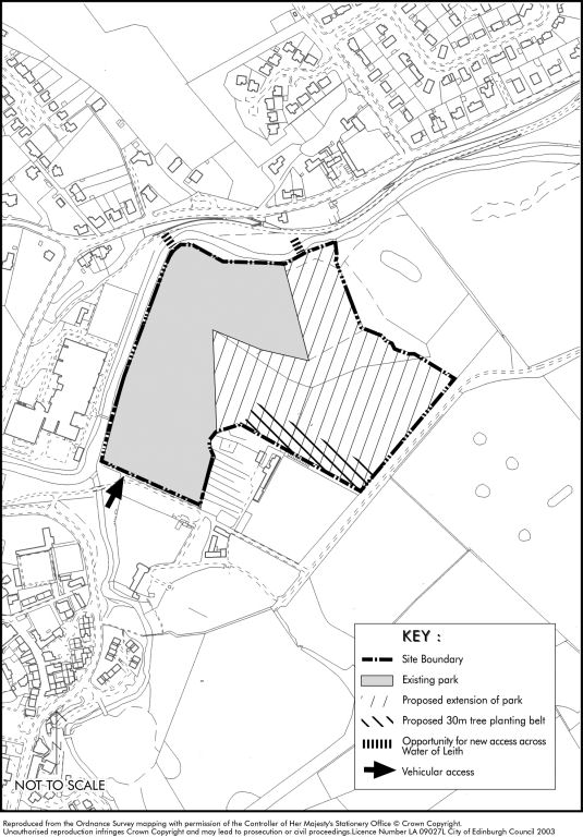
ENV2 Muir Wood Field, Currie
- Site Area: 10.4 hectares
- Ownership: Private
The site is currently in agricultural use and lies within the Green Belt. It has an important role in preventing the coalescence of Currie and Juniper Green. The opportunity exists to enhance the character of the Green Belt and improve recreational open space provision in the Currie/Juniper Green area. The implementation of this proposal is likely to require a partnership approach involving the landowner, the Council, the local community and other interested parties.
Proposals must be appropriate to the site's green belt location and include a public footpath link between Muir Wood Road and Bloomiehall Park.
Suggested uses for the site include:-
- Community woodland;
- Informal kickabout space;
- A safe and attractive recreational footpath network;
- An extension of Baberton golf course.
Proposals should incorporate the following design components as appropriate:-
- maximise public accessibility and enhance the landscape character of the Green Belt;
- create a good relationship between woodland planting and open space as per Forestry Commission guidelines;
- reduce the visual impact of the overhead electricity transmission line; and
- avoid the routing of main footpath links adjacent to the rear gardens of residential properties.