Chapter 9: Transport and other Network Services
Objectives:
- To minimise the distances people need to travel
- To maximise the accessibility of communities to jobs and essential services
- To minimise the detrimental effects of traffic and parking on communities and the environment
- To support the provision of necessary network infrastructure
9.1 This chapter deals mainly with the transport impacts and requirements of new development, but also addresses other network service issues which have some relevance for planning: energy, waste, water supply and drainage, and telecommunications.
Background
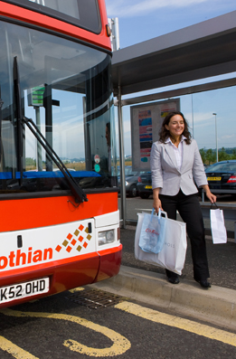
9.2 Edinburgh is a compact city which has managed to sustain relatively high levels of public transport use, walking and cycling compared to other cities. Walking and cycling to the city centre and other places of work are reasonable options for many people living in its more central housing areas. The introduction of bus priority measures on main roads in recent years has helped to make bus travel a convenient and attractive option.
9.3 Nevertheless, increases in the distances that people need to travel, to work, shops and other essential services, is an inescapable consequence of urban growth and the decentralisation of jobs and housing. The amount of commuting across Edinburgh's boundaries in both directions, much of it by car, is growing. The concentration of shopping, hospitals and leisure facilities in larger and more distant units has added to travel demand. New travel destinations have been created in recent years which are more easily reached by car, and increasing car ownership is giving more people that option.
9.4 The consequences of excessive car use and dependency are well known, in terms of congestion and deteriorating air quality, and for the economy, the environment and people who do not have access to a car. An improved transport system based on sustainable alternatives to the car is therefore a high priority for Edinburgh, to tackle congestion, enable everyone to have the best possible access to jobs and essential services and provide wider connections of a quality befitting Edinburgh's role as a capital city and gateway into Scotland. This is the central objective of the Council's Local Transport Strategy, which proposes continued investment in public transport, walking and cycling and in particular a tram network for the main movement corridors.
9.5 Complementary planning policies in the Structure Plan and this Plan support the transport strategy, by seeking to minimise travel demand, ensuring that major travel generating developments take place in locations which are or can be better served by public transport, walking and cycling networks, and resisting development in non-central locations where sustainable travel is not to be provided. Other policies in this Plan can also help reduce car dependency by encouraging higher densities and mixed use developments which bring homes, shops and work places closer together, and by paying careful attention to the design of development and car parking provision.
9.6 The Council's current Local Transport Strategy 2007, additionally sets out traffic reduction, mode share and related environmental targets which are relevant to the consideration of planning applications for major travel generating development.
Transport Policies
Transport Assessment
9.7 Every development has a transport impact, and all planning applications that involve the generation of person trips should provide information on the demands that will be made on the road network and transport system. For development proposals generating a significant amount of travel and proposals for sites in particularly traffic sensitive locations, a comprehensive transport assessment must be prepared and submitted with the planning application. The aim of an assessment is to ensure maximum feasible sustainable transport access to a development. Assessment should include a prediction of the number of trips likely to be made to the development and the modal split, together with details of measures to improve or maximise access by public transport, walking and cycling and minimise and deal with impacts of car journeys associated with the proposal. The Assessment should include a reference to traffic reduction and mode share targets set out in the Local Transport Strategy current at the time of application.
Location of Major Travel Generating Development
Policy Tra 1 - Location of Major Development
Planning permission for development which would generate significant travel demand will be permitted on suitable sites in the Central Area. Where a non-central area site is proposed, the suitability of a proposal will be assessed having regard to:
- the accessibility of the site by modes other than the car
- the contribution the proposal makes to Local Transport Strategy objectives and the effect on targets in respect of overall travel patterns and car use
- impact of any travel demand generated by the new development on the existing road and public transport networks.
In general, applicants should demonstrate that the location proposed is suitable with regard to access by public transport, cycling and walking and that measures will be taken to mitigate any adverse effects on networks and bring accessibility by non-car modes up to acceptable levels if necessary.
9.8 The policy applies to major offices, retail, entertainment, sport and leisure uses and other non-residential developments which generate a large number of visits by employees and other visitors (personal trips). These developments should be accessible by a choice of means of transport which offer real alternatives to the car. For this reason, a location in the Central Area will normally be preferable. Major travel generating developments will also be encouraged to locate in the identified town centres and employment centres, provided that the scale and nature of the development is such that it can be reached conveniently by a majority of the population in its catchment area by regular and frequent public transport services or on foot. Out-of-centre development will only be acceptable where it can clearly be demonstrated that the location is suitable, and will not encourage more car use compared with a more central location. This means that good public transport accessibility will still need to be assured.
Planning Agreements
Policy Tra 2 - Planning Agreements
Where appropriate, planning permission for major development likely to give rise to additional journeys will be subject to planning agreements to secure:
- the implementation and subsequent monitoring of a travel plan with proposals for promoting and delivering sustainable travel by occupiers after the development is completed
- new or improved pedestrian and cycle access and facilities in the vicinity of the site
- new or improved public transport access to the site, including the provision of infrastructure and/or financial support for bus services and the development of the proposed tram network
- improvements in the surrounding road network where necessary to accommodate in a sustainable and acceptable manner the traffic likely to be generated by the development without encouraging greater car use or causing or adding to congestion
- any other relevant considerations arising from the Transport Assessment.
Policy Tra 3 Tram Contributions
Where the proposed tram network will help to address the transport impacts of a development, a contribution will be sought towards its construction and associated public realm works. The contribution will be in addition to any that may be required in accordance with Policy Tra 2 above. Contributions will continue to be sought after construction works are completed and until associated borrowings have been repaid.
9.9 The Council will enter into planning agreements to ensure that a development will be carried out in an acceptable manner in transport terms and offset the potentially detrimental effects of development for the environment, health and safety. The aim will be to ensure maximum feasible public transport and other sustainable access to a site. This may include the provision of or financial contributions towards appropriate off-site transport measures in the surrounding area, such as road junction improvements, parking management and preparing and implementing a traffic regulation order. It may include financial support for bus, tram, park and ride or rail services. It may also include financial contributions towards transport measures which are necessary to address the cumulative impact of development in a more general location and over time, even if this cannot currently be foreseen with certainty. The preparation of master plans for Granton and Leith is assisting the Council in identifying the likely impact of development in these areas and by numerous developers, and enabling it to identify the transport improvement measures required.
9.10 The tram will have a major influence on travel patterns in the city. It will enhance the accessibility of the city centre and key growth areas in Leith and Granton. It will address the transport impacts of future development over a wide area, including the critical growth areas of the city: in the city centre, Leith, west Edinburgh, Granton in the longer term and further ahead still, the South East Wedge. Without the tram, growth targets and aspirations in these areas could not be achieved in full. It is reasonable therefore that the developments which will directly benefit from the tram should contribute towards its construction costs, including associated public realm costs. Supplementary planning guidance has been approved which sets out the criteria by which contributions will be sought. The policy applies to all development within 500 metres of a proposed tram line or 750 metres of a tram stop, but may also be applied to individual developments beyond these limits if warranted by their scale and likely travel demands. Contributions will be adjusted to take account of development type, scale and distance from the agreed corridors and stops. The above policy should be read in conjunction with the supplementary guidance.
9.11 Traffic generation can have other adverse environmental effects, notably on local air quality, which may need to be mitigated in accordance with Policy Env 18. Appropriate mitigation measures may form part of transport-related conditions or agreements, for example financial support for low/no-emission bus vehicles serving the development.
9.12 Travel plans are documents that set out a package of positive and complementary measures for the overall delivery of more sustainable travel patterns after a development is completed and occupied. They could deal for example with workplace car parking and how this is managed, or the inducements which can be put in place by employers for staff and customers to use alternatives to the car. They will therefore be required from all developments requiring transport assessment, and are a valid matter to be dealt with in the context of a planning agreement. Their effectiveness will need to be monitored, and therefore a travel plan should include specific mode share targets which can be reviewed on a regular basis by occupiers and the Council. They are not applicable to residential developments, where sustainability in travel should come from design in relation to walking, cycling and public transport networks.
Private Parking
Policy Tra 4 - Private Car Parking
Planning permission will be granted for development where the car parking provision to be made complies with and does not exceed the parking levels set out in supplementary planning guidance. Lower provision will be pursued subject to consideration of the following factors:
- whether, in the case of non-residential developments, the applicant can demonstrate through a travel plan that practical measures can be undertaken to significantly reduce the use of private cars to travel to and from the site
- whether there will be any adverse impact on the amenity of neighbouring occupiers, particularly residential occupiers through on-street parking around the site and whether any adverse impacts can be mitigated through control of on-street parking
- the accessibility of the site to public transport stops on routes well served by public transport, shops, schools and centres of employment
- the availability of existing off-street parking spaces that could adequately cater for the proposed development
- whether the characteristics of the proposed use are such that car ownership and use by potential occupiers will be low, such as purpose-built sheltered or student housing and 'car free' or 'car reduced' housing developments and others providing car sharing arrangements
- whether complementary measures can be put in place to make it more convenient for residents not to own a car, including secure, covered cycle parking, car sharing or pooling arrangements, including access to the city's car club scheme.
Policy Tra 5 - Private Cycle Parking
Planning permission will be granted for development where the cycle parking and storage provision to be made complies with the standards set out in supplementary planning guidance.
9.13 Car parking provision is an essential tool of planning and transport strategies. The amount of car parking available at a travel destination to staff, customers, visitors etc. has a major influence on how people choose to travel. This must be provided in accordance with Council standards which have been prepared for the city and are tailored to local circumstances, including location, public transport accessibility in the surrounding area and economic needs, but generally fulfil the wider strategy of encouragement of sustainable, non-car modes. The standards express the maximum amount of car parking that different types of development may provide. More restrictive maximum parking levels, including nil provision for some types of development, are in place for the city centre because of its high accessibility and for locations near to the main public transport corridors.
9.14 Less car parking than the standards require may be appropriate if this will help reduce car use. The policy indicates the circumstances in which this may be agreed. The standards allow for the development of 'car free' or 'car reduced' housing schemes, provided developers are prepared to enter into planning agreements to ensure that residents will have every inducement not to keep a car within the scheme or its vicinity. A model for this is the successful and widely reported scheme at Slateford Green. A successful car club operates in the city, a form of pooled car ownership and sharing. Proximity to car club parking facilities would be an advantage to developers seeking to provide less than the standard car parking provision. At least half the space saved by omitting or reducing car parking should be given over to landscape features and additional private open space (read Policy Hou 3), so that residents will have the amenity benefits of a car-free environment. Parking provision at levels below those set out in the standards, including car-free housing, is only likely to be acceptable in locations which are subject to on-street parking controls, or will become so in association with the development.
9.15 The provision of adequate cycle parking and storage facilities is important in meeting the objective of the Local Transport Strategy to increase the proportion of journeys made by cycle. The Council's parking standards set out the required levels of provision of cycle parking and storage facilities in housing developments and a range of non-residential developments.
Design of Car and Cycle Parking
Policy Tra 6 - Design of Off-Street Car and Cycle Parking
Where off-street car parking provision is required or considered to be acceptable, the following design considerations will be taken into account:
- surface car parks should not be located in front of buildings where the building would otherwise create an active frontage onto a public space or street, and main entrances to buildings should be located as close as practical to the main site entrance
- car parking should preferably be provided at basement level within a building and not at ground or street level where this would be at the expense of an active frontage onto a public street, public space or private open space
- the design of surface car parks should include structure planting to minimise visual impact
- the design of surface car parking or entrances to car parking in buildings should not compromise pedestrian safety and should assist their safe movement to and from parked cars, for example, by the provision of marked walkways.
Cycle parking should similarly be provided close to entrances, preferably in covered and secure locations, to encourage cycle use.
9.16 Car parking can be harmful to environmental quality and where provided in remote, unsupervised and out of sight locations can create security problems. All surface car parks should therefore be subject to good natural surveillance. Car parking in front of supermarkets, widely separating entrances from main roads, is an added discouragement to public transport use and walking, and detracts from urban vitality and safety. A high standard of design for surface car parking will be sought, with landscaping to soften its visual impact, and in larger car parks the provision of marked walkways for ease of pedestrian movement and safety. Ground floor parking within buildings and the resulting blank frontages can have similar detrimental effects on the safety and vitality experienced in adjacent streets. In many situations, the provision of car parking at basement or semi-basement level is encouraged to permit active uses at ground floor level and reduce the amount of land required for surface parking. However, underground car parks are difficult to manage in terms of security, especially when provided for residential parking purposes. These must be designed with good natural surveillance at entrance points and incorporate adequate access control and formal surveillance measures.
Detailed Proposals and Transport Safeguards
9.17 Additional transport infrastructure will be needed in Edinburgh, to provide for its growth requirements and assist the development of more sustainable patterns of travel. The following policies and safeguards arise from committed proposals and policy requirements of the Local Transport Strategy or the Structure Plan, where these have implications for the future use of land and its development. Each can be related to a designation on the Proposals Map. Proposals that require to be safeguarded in the Plan and in decisions on planning applications are:
- Edinburgh Tram: proposal for three lines
- 'park and ride' sites on the urban edge, including the expansion of existing sites
- public transport interchanges at Waverley Station and Haymarket Station
- rail halts
- the road network
- the cycle path and footpath network
- city centre car parking
- freight transport
- port and ferry terminal facilities for cruise liners and a cross-Forth ferry service.
Tram
Policy Tra 7 - Tram
Planning permission will not be granted for development which would prejudice the construction of the infrastructure necessary for a tram network or of dedicated busways on the routes shown indicatively for each of these purposes on the Proposals Map.
9.18 The Edinburgh Tram project is the largest infrastructure proposal to improve the city's overall transport networks. Parliamentary approval has been given to the construction of the tram lines shown on the Proposals Map. Phase 1a, to be built first, will run from the airport through Edinburgh Park, the city centre to Ocean Terminal and Newhaven. Phase 1b, to be built at a later date, will run from a connection with phase 1a at Roseburn to Granton. The Proposals Map also shows two routes to be safeguarded for longer term extensions of the system. One consists of an extension of phases 1a and 1b between Newhaven and Granton to complete a loop. The other is a line from the city centre to Newcraighall via the Royal Infirmary and Greendykes. The tram will have a major influence over travel patterns, secure the accessibility of the city centre and enhance the accessibility of key growth areas in Leith and Granton. The planned tram stops are also shown on the Proposals Map. Higher density, mixed use developments will in principle be acceptable around tram stops. The potential to extend this line southwards along or adjacent to Dalkeith Road to its junction with the City Bypass road at Sheriffhall is also safeguarded.
9.19 The tram will be part funded by contributions from developers benefiting from its construction, and a payments formula has been approved, applying to development which takes place up to a distance of 750 metres. Details are set out in a separate planning guideline. A significant amount of development is likely to take place after the tram is built and running. The requirement for contributions from developers will remain until borrowings to fund construction have been discharged.
9.20 The Tram Acts have the effect of granting planning permission for the construction of tram phases 1a and 1b within certain defined 'limits of deviation'. The Acts have introduced a special planning process called 'prior approval'. Proposals will now be submitted to the Council for 'prior approval', but may only be refused or conditions imposed on an approval, if an alternative alignment within the limits of deviation is available, or if the design is reasonably capable of modification. The Council will seek the highest standard of design within its powers and its advisory role, ensuring that adverse effects on the existing environment are minimised. For these purposes and to guide the tram system designers, the Council has prepared the Tram Design Manual and a series of urban design briefs for the tram route. A reference to these and other relevant guidelines should be made in the design statements to be submitted with the prior approval applications. Whilst it is only the tram system design that will come to the Council for prior approval, regard will be had to the longer term scope for re-designing the streetscape and the wider public realm through which the tram will pass.
9.21 Significant progress has been made in making bus
transport an effective and attractive travel option in Edinburgh, largely
through on-street measures such as bus priority lanes and real-time information
at bus stops. Where appropriate, the Council will seek contributions from
developers towards further highway improvements that will assist bus travel.
The Council will also safeguard land which has the potential for development as
dedicated bus ways or extensions to the tram network as it currently stands.
The disused rail network in the city is a unique asset in this regard. Policy
Tra 13 seeks to safeguard these at least for use as footpaths and cyclepaths,
the least expensive option and relevant to all disused lines. The Structure
Plan requires their safeguarding also for public transport use if there is
reasonable prospect of such re-use. The line between Danderhall and the City
Bypass at Straiton in this local plan area has the potential to form part of an
orbital busway and is therefore identified on the Proposals Map. Its use as
part of the footpath/cyclepath network will also be supported. Other disused
lines in Edinburgh will be assessed for their potential in these terms in the
context of local and regional strategies. The Council is also seeking
development-led improvements, in the form of a Greendykes/Royal Infirmary
bus-only link road, and a similar link between Newcraighall and Queen Margaret
University College in East Lothian. The routes for these are also identified on
the Proposals Map.
Park and Ride
Policy Tra 8 - Park and Ride
Long-stay car parks will be permitted on sites closely related to public transport corridors and railway stations provided visual impacts can be ameliorated through careful design and landscaping. The following sites shown on the Proposals Map will be safeguarded for future possible car park and ride purposes:
- Newcraighall - extension of existing facility
- Ferniehill - required if the site developed at Todhills in Midlothian, on the same public transport corridor, proves insufficient to meet demand
9.22 Safe, convenient and secure park and ride facilities linked to efficient public transport services can help reduce congestion. The Council is developing a string of park and ride facilities around the periphery of the city to provide for long-stay and commuter parking which does not necessarily need to be in the city centre, and this will continue as suitable sites can be identified. Existing sites at Hermiston and Ingliston, beyond the City Bypass road, are already well used, and it is likely that they will need to be expanded to meet demand. Green Belt locations will inevitably have to be considered for park and ride developments, and the Council will minimise their adverse effects on rural amenity through careful siting, design and landscaping.
Public Transport Interchanges
Policy Tra 9 - Public Transport Interchanges
Development of Waverley Station and Haymarket Station as major public transport interchanges will be permitted, in conjunction with other transport proposals that will enhance their accessibility and connectivity with non-rail modes. Non-rail related commercial developments will be permitted which facilitate modernisation, but proposals must be appropriate to their location, contributing towards city centre vitality and complementing the historic character of their surroundings.
9.23 Waverley and Haymarket are Edinburgh's key rail gateways for regional and local travel. Although visually a problematic feature in the historic townscape, the centrality of the main railway station in Edinburgh, on a 'through' line, has always been a great advantage to the city. However, the steady rise in rail travel is bringing the system in Edinburgh, particularly the capacity of Waverley and Haymarket stations, up against constraints. These will be relieved to some extent by a major project to provide additional platforms, escalators and lifts at Waverley and Haymarket. However, rail travel options in the Edinburgh region are set to be enhanced with the proposed re-opening of the Borders rail link, the proposed rail link to Edinburgh Airport and the re-establishment of a third link to Glasgow, via Bathgate and Airdrie.
9.24 In the longer term, the Council wishes to see a more substantial improvement to Waverley Station, providing additional train capacity and improved passenger facilities. This is part of government and Council aspiration for the rail system, that it should provide an effective alternative to air travel nationally and road travel in a regional context. The Council's headquarter building on surplus railway land has provided a new, high quality urban frontage which will have wider regenerative impacts on the Old Town with the redevelopment of 'Caltongate' (Proposal CA 2). The possibility of providing further business or commercial development on land which is part of the station complex has arisen from time to time, and there is no reason for ruling out good proposals. As well as improving the station in operational and access terms, proposals must enhance the gateway experience that major city centre stations provide. They must be appropriate in urban design terms to the historic setting, which will always be an enormous challenge for a station in the heart of an historic city. Consideration should be given to the scope for providing attractive, convenient linkages for pedestrians across the Waverley valley.
9.25 The Council is also progressing a proposal to redevelop Haymarket station and surrounding area, to provide a key multi-modal interchange in the west end of the city centre. The interchange should not only meet connectivity requirements, but should support regeneration in the area and improvement of the public realm around the station.
Rail Network
Policy Tra 10 - Rail Halts
Planning permission will not be granted for development which would prejudice the construction of:
- rail halts at Portobello (Station Brae), Piershill and Meadowbank
- the route and rail halts shown on the Proposals Map on the Edinburgh South Suburban Railway to be safeguarded for the possible re-introduction of passenger services.
9.26 The Council has long pressed for the reintroduction of passenger services on the Edinburgh South Suburban Railway, currently in use for freight traffic only. Although not seen as viable or practical by the rail authority at this time, the Local Plan will continue to ensure that development does not prejudice the possible re-use of existing abandoned passenger halts on the line and the construction of new halts in some expedient locations. These halts are shown on the Proposals Map with the existing line.
Rail Freight
Policy Tra 11 - Rail Freight
Planning permission will not be granted for development which would prejudice the retention of viable freight transfer facilities at Seafield and Portobello.
9.27 There are rail freight transfer facilities at a limited number of locations in Edinburgh: Powderhall, Portobello and the eastern docks area in Leith. The Powderhall facility is used only for waste transfer. The future of the remaining facilities is not clear. Some transfer of freight from water to rail takes place in Leith Eastern Docks, but the implications of Forth Ports’ proposals for the redevelopment of the docks is that there is no long term requirement for this facility. The marshalling yards at Millerhill in Midlothian are likely to be better placed to fulfil a road-rail transfer function for the city region in the longer term than any comparable site or facilities in Edinburgh. However, it seems prudent to retain at least a minimum of freight transfer capacity within the city, based on existing mineral rail lines, and therefore the Council will seek to achieve this through the retention of facilities at Seafield and Portobello. A rail head at Seafield may be important if the decision is made to build a waste management facility at this location. It also keeps open the possibility of rail access into Leith Docks, should the need arise.
New Roads
Policy Tra 12 - New Roads
Planning permission will not be granted for development which would prejudice the construction of new roads at Leith Docks (eastwards and westwards extensions of Ocean Drive) and Newcraighall (The Wisp realignment) as shown on the Proposals Map. New road space for car traffic will be permitted as an integral and necessary part of new development, but layouts should be designed so as not to encourage greater car use or cause or add to congestion in the surrounding area.
9.28 There are no highway schemes currently proposed by the Council or by the government affecting land in this local plan area with the exception of a link road between the Royal Infirmary/Centre for Biomedical Research access road and Greendykes. This link will be restricted to public transport (bus and potentially tram use), pedestrians and cyclists only. Any new road construction in this local plan area will arise from development proposals and be directly related to their needs, in accordance with Policy Tra 2 above. This is in line with the Council's general approach which is not to promote road construction which will increase the capacity of the road network generally. Any such construction should comply with objectives and standards set out in separate guidance issued by the Council, in its Movement and Development guidelines, as reflected in Policy Des 4.
9.29 Extensive new road construction is proposed as part of the major regeneration proposals for the waterfront and at Craigmillar. The Council will seek to ensure that this brings wider benefits. The new road construction proposed in Leith Docks will reduce the amount of traffic on existing roads in Leith (Bernard Street and Commercial Street) and allow environmental improvements with benefits to pedestrians on these. The route for this agreed in the Leith Docks Development Framework is safeguarded on the Proposals Map. The other safeguard referred to in the policy and identified on the Proposals Map is intended to improve traffic conditions on eastern approaches to Fort Kinnaird retail park in Newcraighall. Traffic conditions at the Sheriffhall roundabout junction of the A720 City Bypass with the A7 and A68 roads are a matter of concern to the local authorities. The need for reconstruction as a grade separated junction to increase capacity is identified in the Structure Plan as a key transport investment proposal to be safeguarded pending decisions by the Scottish Government, the trunk road authority. For this reason, and to make sure development proposals take into account the functioning of the junction, it has been identified indicatively on the Proposals Map.
The Cycle and Footpath Network
Policy Tra 13 - Former Rail Alignments and Cycle and Footpath Network
Planning permission will not be granted for development which would:
- prevent the implementation of proposed cycle paths/footpaths shown on the Proposals Map
- be detrimental to a path which forms part of the core paths network or would prejudice the continuity of the off-road network generally
- obstruct or adversely affect a public right of way unless satisfactory provision is made for its replacement
- prejudice the possible development of an abandoned railway alignment for an alternative acceptable public transport purpose or its incorporation into the off-road path network.
9.30 Encouragement of walking and cycling is at the heart of government and Council proposals to promote more sustainable travel, improve health and provide equally for people who for whatever reason do not own a car. Provision for cyclists and people on foot is therefore a priority consideration when new development is proposed. In most parts of the city, this is a consideration for the road network and how it is designed, or improved through traffic management measures and techniques. Segregated paths in housing areas for example can be an unwelcome feature, compromising safety and security in the residential environment. However, over several decades an extensive, highly attractive and relatively connected off-road network has been developed, using abandoned railway alignments, laying out paths on river banks and using the canal towpath. This gives some neighbourhoods exceptionally good leisure and journey-to-work options. There may now be relatively few opportunities to extend the path network. One important opportunity will arise if the decision is taken to relocate the waste management and transfer facilities away from Powderhall. This will be acquired for conversion to a path, and will provide a valuable link between existing paths in the network.
9.31 Policies in this Plan state that opportunities to extend or link into the network will be considered when development proposals come forward. In this connection, it is of the utmost importance that the paths provided for in the master plans and development frameworks for Leith and Granton are implemented. These include the major new links in the Council’s proposals for a high quality waterfront promenade of significant dimensions from the Almond to the Esk. The Structure Plan states that railway alignments should be safeguarded for public transport use as well as for foot and cycle paths, and accordingly the tram proposal will utilise the Roseburn to Crewe Toll former railway alignment, but will reinstate a new path for pedestrian and cycle use. Most of the city's former rail alignments are now safeguarded as core paths. These and other former rail routes represent a valuable asset and development proposals will be assessed to make sure the technical integrity of the route for possible future public transport purposes (e.g. rail, tram or guided busways), as well as for cycle/footway use is not compromised. They are also often wildlife corridors and in implementing proposals steps will be taken where possible to retain their nature conservation value.
9.32 The Land Reform (Scotland) Act 2003 introduced a new right of responsible access to most land and inland water across Scotland. It introduced also a duty on all local authorities to prepare a core paths plan for their area. The purpose of a core paths plan is to map a system of paths sufficient for the purpose of giving the public reasonable non-motorised access throughout the local authority area. The City of Edinburgh Council approved its Core Paths Plan in May 2008. This is based primarily on existing well-established paths, although opportunities for its future development are also identified. The Council will now have regard to this system of core paths and how it may be protected, improved and extended when development is proposed. The existence of a core path will be a material consideration when planning applications are determined, and the network will provide a basis for promoting further off-road access when opportunities arise, in accordance with design Policy Des 4. The core paths are shown in Appendix C of this plan. Proposals Map designations, including open space designations, cycle/footpath safeguards and transport safeguards are consistent with the core paths network, which will be reviewed in parallel with preparation of future open space strategies and reviews of the local plan.
City Centre Public Car Parking
Policy Tra 14 - City Centre Public Parking
Planning permission will be granted for well-designed short-stay public off-street car parks at suitable locations in the Central Area to meet the needs of shoppers and leisure visitors, provided there will be no adverse effects for the historic environment.
9.33 Additional purpose-built off-street car parking can be justified in the city centre, to meet the needs of shoppers and leisure visitors primarily, to boost the city centre's shopping functions and enable it to compete more effectively with other shopping centres. Off-street car parking provision is also to be preferred to the wide-spread use of streets in the city centre for parking; it is less visible and obtrusive and could enable pavements to be widened. The west and north-west edges of the city centre retail core have in particular been identified as areas where short- and medium-stay public off-street parking would be beneficial and reduce the amount of traffic circulating and seeking spaces to park. However, the location and design of built car parks in Edinburgh city centre's historic environment is itself a challenging proposition. One idea which is currently being assessed for its feasibility is that of building car parks below street level with access to be provided by lift mechanisms rather than ramps.
Port and Ferry Terminals
Policy Tra 15 - Port and Ferry Terminals
Planning permission will be granted for the development in appropriate locations of a cross-Forth ferry terminal and for an improved deep water cruise liner terminal.
9.34 Cruise liners visit Edinburgh with increasing regularity, and this is an important contribution to Edinburgh's tourism functions and economy. Depth of water limits the size of ships that can reach the existing terminal within Leith Docks; larger ships have to be moored in the Firth of Forth. The port company has long term plans to build new docking facilities in open water, to cater for cruise ships of all sizes. A potential site for this has been identified in the Leith Docks Development Framework.
9.35 A cross-Forth ferry service would provide an alternative mode of travel between Edinburgh and Fife, and could benefit commuters particularly. Private companies have investigated the feasibility of this, which could form a useful addition to the range of measures by which the Council can seek to influence travel decisions and reduce car dependency. Any ferry terminal should be located where it could be conveniently served by public transport, preferably the proposed tram. A specific site has not yet been identified, but the requirement will be a consideration when waterfront redevelopment between Granton and the shipping entrance to Leith Docks is proposed.
Other Network Infrastructure issues
Waste Management
Policy Inf 1 - Provision and Safeguarding of Community Recycling Facilities
Planning permission will be granted for community recycling centres on employment land and on other suitable sites in the urban area where there will be no adverse impact on communities or the environment. Development in the area immediately surrounding an existing or consented community recycling facility, including those identified on the Proposals Map, will only be permitted if it is demonstrated that there will be no adverse implications for the approved waste handling operations. The provision of small-scale recycling facilities will be sought in appropriate developments, such as large foodstores.
Policy Inf 2 - Provision of Integrated Waste Management Facilities
Planning permission will be granted for waste management facilities on land designated ‘business and industry’ on the Proposals Map where it is demonstrated that there is a need for the facility and that the proposal represents the best practicable environmental option. Development generally on employment land at Seafield (designated BUS 3 on the Proposals Map) will only be permitted which preserves the option of building an integrated waste management facility with rail access at this location, incorporating thermal treatment with energy recovery.
Policy Inf 3 - Waste Disposal Sites
Proposals for new landfill or land raise sites will not be permitted. An exception may be made where it is demonstrated that there will be significant environmental benefits and no dis-benefits and the operation is the best practicable environmental option for a particular waste stream.
9.36 The amount of waste produced by society is continually rising, and dealing with waste is a major environmental problem and issue for sustainability. Until recently, most waste was dumped indiscriminately in landfill sites, but this is environmentally damaging, and Government policy now requires radical changes in the way waste is dealt with, including a sharp reduction in the amount going to landfill and its replacement by more sustainable alternatives. Through the National Waste Strategy the Government has set challenging targets for the reduction and more sustainable treatment of waste.
9.37 The National Waste Strategy Scotland establishes key principles which need to be taken into account in planning for waste management. These include the ‘waste hierarchy’ of options for treating waste, beginning with prevention at source, followed by re-use, re-cycling and finally recovery of value before disposal to landfill. Recovery of value can include composting and the thermal treatment of waste to recover energy. The proximity principle is also important, meaning the management of waste as near as possible to its places of production, as transport itself has an environmental impact. The ‘Best Practicable Environmental Option’ (BPEO) approach must be taken to the assessment of proposals.
9.38 The National Waste Plan for Scotland and Area Waste Plans describe the activities, key infrastructure and targets for each of eleven waste plan areas in Scotland. The Lothian and Borders Area Waste Plan was adopted for the Edinburgh region in 2003. The Council is developing an integrated waste management strategy within the context of the national and area waste plans. Public/private partnership opportunities will be explored to implement this strategy. This will require a renewal and expansion of the facilities available in the city to deal with waste in accordance with the proximity and other principles of the national strategy. These facilities will range from the small-scale ‘bring’ recycling sites for various materials, including the banks of containers which are now familiar in most large foodstores and shopping centres. There are currently four community recycling centres (civic amenity sites) in or on the edge of the urban area, and land for further centres is required and will be sought. These in principle should be located in industrial areas, but other sites in the urban area such as disused quarries can provide the necessary insulation from housing areas. Government guidance states that these should be identified and safeguarded in Local Plans as important components of an integrated network.
9.39 The central collecting and bulking facility for municipal waste prior to transfer in Edinburgh is at Powderhall. This will continue for the immediate future, but it is likely that additional facilities will be needed at some stage, integrating a wider range of treatment options. Land at Seafield has exceptional advantages: it is sufficiently remote from housing areas; it has the benefit of rail access; and it has an outlet in the Leith Docks regeneration areas for energy recovered after thermal treatment, if a decision is made to build an integrated facility with thermal treatment capacity. If a need for further management facilities on this scale arises, the areas of search will be the designated ‘business and industry’ areas in this Local Plan, and proposals will have to be further justified by reference to needs identified in the national and area waste plans. Proposals for facilities to handle non-municipal waste will need to be justified and assessed in the same way.
9.40 Waste issues are addressed in two other policies of the Local Plan. Policy Des 3 is intended to ensure that waste issues are addressed in design terms at the planning stage for all new development. This will avoid the possible loss of landscaped areas or road space if facilities have to be retro-fitted after construction. Policy Des 6 addresses recycling as part of the battery of sustainability issues that all development must address, in conformity with the Council’s Standards for Sustainable Building. Waste management is a fast-changing industry, and new and cleaner technologies are emerging. As examples of this, Edinburgh has seen the installation of underground collecting chambers in the Grassmarket, whilst consideration is being given to the potential for transporting waste in the city centre through suction pipes.
9.41 This Plan does not identify opportunities for the disposal of residual municipal waste or other forms of waste to landfill sites in this local plan area and similarly opposes land raise operations unless there will be demonstrable benefits to the appearance of the environment and no harmful impacts.
Renewable Energy Developments
Policy Inf 4 - Renewable Energy
Planning permission will be granted for development of renewable and sustainable energy schemes such as small-scale wind turbine generators, solar panels, combined heat and power/district heating/energy from waste plants and biomass/woodfuel energy systems provided the proposals:
- do not cause significant harm to the local environment, including the character and appearance of listed buildings and conservation areas and
- will not unacceptably affect the amenity of neighbouring occupiers by reason of, for example, noise emission or visual dominance.
9.42 The Government is committed to increasing the amount of renewable energy used in Scotland, and has set challenging but achievable targets, as part of the drive to reduce carbon emissions. Government guidance through draft SPP 6 asks local authorities to consider and identify the contribution that is possible in their areas to meeting energy needs through renewable sources. Much of the capacity for meeting national targets will come from large scale developments such as wind farms which are not appropriate for location in an urban area or the Green Belt. However, new technologies are emerging which allow energy to be generated on a small-scale and in urban areas. These include devices which can be mounted on existing buildings or integrated into the design of new development. Consideration of these issues at the start of the design process should enable measures to be incorporated in new buildings in ways which do not compromise other important design issues, and this is included therefore in the scope of Policy Des 6 Sustainable Design. The above policy supports the installation of renewable energy equipment on existing buildings, but consideration has also to be given to their acceptability on listed buildings and in conservation areas, especially in the World Heritage Site.
9.43 Other technologies have the potential to contribute towards energy saving targets and provide more sustainable sources of energy and may be appropriate for location on suitable sites in the urban area. These include energy from waste and biomass/woodfuel energy systems. Combined heat and power (CHP) plants, although not necessarily using renewable sources, offer significant efficiencies and carbon savings because waste heat is piped to the surrounding area for heating and the electricity generated is locally consumed. Growing attention is being paid to the potential of combined heat and power technologies, and in Edinburgh the scale of development in prospect in the major growth areas offers important opportunities for the construction of the necessary plant, which the Council wishes to see explored.
Radio Telecommunications Developments
Policy Inf 5 - Telecommunications
Planning permission will be granted for telecommunications development provided:
- the visual impact of the proposed development has been minimised through careful siting, design and, where appropriate, landscaping
- it has been demonstrated that all practicable options and alternative sites have been considered, including the possibility of using existing masts, structures and buildings and/or site sharing
- the proposal would not harm the built or natural heritage of the city.
9.44 The provision of new telecommunications infrastructure is essential to economic competitiveness: the telecommunications industry is passing through a period of rapid expansion and must be enabled to expand and diversify, but this must be undertaken sensitively and imaginatively, and with minimum environmental impact. Telecommunications equipment such as antennas, mobile phone masts and base stations can have a significant visual impact in both urban and rural areas. Telecommunications operators are therefore required to demonstrate that all practicable options to minimise impact have been explored, and the best solution identified. There will be a limited number of locations, including city landmarks such as Arthur's Seat and Salisbury Craigs, where the impact of an installation cannot be satisfactorily minimised, and where it will therefore be unacceptable in principle. In other locations, individual proposals may be acceptable but where there is a concentration of these uses, consideration will be given to the cumulative visual impact. Conditions will be imposed on any consent, requiring the removal of any mast or apparatus and the reinstatement of a site to its former condition when it becomes redundant.
Water Supply
Policy Inf 6 - Water and Drainage
Planning permission will not be granted where there is an inadequate water supply or sewerage available to meet the demands of the development and necessary improvements cannot be provided.
9.45 Scottish Water is developing a strategy for water supply, treatment and distribution to meet current and future demands in the City of Edinburgh and the Lothian council areas, and to ensure that the enhanced drinking water quality standards set in government and EU regulations are met. This is being implemented through the replacement of the main storage and treatment facilities in Edinburgh, at Fairmilehead and Alnwickhill, with a new facility at Glencorse in Midlothian. Water is a sustainability issue that has been brought within the scope of the policy for sustainable design (read Policy Des 6); accordingly, water consumption should be minimised by design in new developments, as provided for in the Edinburgh Standards for Sustainable Building.